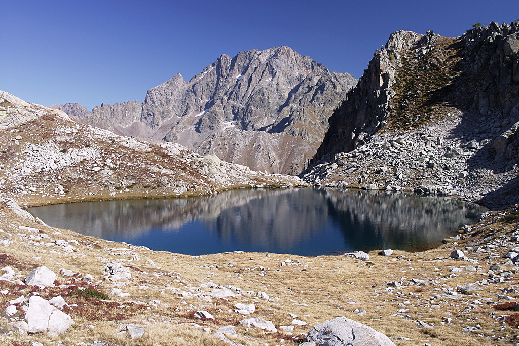
The Fremamorta Lakes circle
1 point of interest
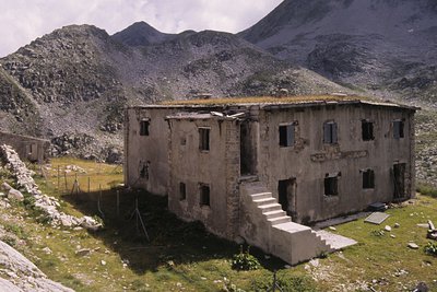
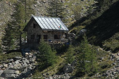
Il ricovero Umberto I - Roberto Pockaj  History and historical trail
The Umberto I shelter
This is in fact a large barracks, designed to house 130 soldiers and 4 officers. Built in 1894, it was readapted on three separate occasions, the last of which in 1934, when another section was added on one side of the main building to house the kitchen, and a freestanding structure was also erected. The ruins of an old storage barn and stables can be seen just above the barracks.
Description
From the high parking area of Gias delle Mosche (1592 m), where the asphalt ends, you go down towards the stream which you cross on a footbridge. The path continues towards the valley where it climbs up a detrital cone, continuing with an infinite series of hairpin bends inside the sparse larch wood. The path crosses to the south, loses altitude to go around a section in landslide, and starts to climb again. A long series of hairpin bends leads to the former military mule track that connected Valscura with Fremamorta, reached at the lake below Fremamorta (2354 m, 2:45 hours from the parking area).
Go to the left and, having passed the track on the left for the Bivacco Guiglia (2426m, recommended detour for the panorama), you reach the median lake of Fremamorta (2375m).
Ignore the path to Pian della Casa on the left and continue up to the ruins of the large Caserma Umberto I, where there is another crossroads on the left for Pian della Casa, used for the return.
First, however, the digression up to the two soprano lakes of Fremamorta is recommended (2371 m the largest of them, 0:30 hours from the lake below Fremamorta).
Returning to the Umberto I barracks, take the path (now on the right) which joins up with the mule track coming from Pian della Casa. Follow it to the right, descending to the edge of the Gias sottotano della Losa basin (here ignore the track to the left for Pian della Casa, for expert hikers), and go up to cross a ridge.
On the ridge, ignore the path to Colle di Fremamorta on the right and continue to descend with numerous hairpin bends until you enter the wider path leading to Colle di Ciriegia. Go left and you reach Pian della Casa del Re (or just Pian della Casa, 1735 m, 2:00 hours from the Soprani lakes of Fremamorta).
After crossing the stream over a bridge, take the dirt road in the direction of Terme and return to the Gias delle Mosche car park (1592 m, 0.30 hours from Pian della Casa del Re).
- Departure : Parking lot at the Gias delle Mosche (1592 m)
- Arrival : Upper Fremamorta Lakes (2371 m)
- Towns crossed : Valdieri
Altimetric profile
Recommandations
Transport
SNCF line TER Provence Alpes-Côte d'Azur For travel in the PACA region and towards Cuneo www.ter-sncf.com/pac
Trenitalia for travel in the Piedmont region https://www.trenitalia.com/it.html
Access and parking
Parking :
Report a problem or an error
If you have found an error on this page or if you have noticed any problems during your hike, please report them to us here: