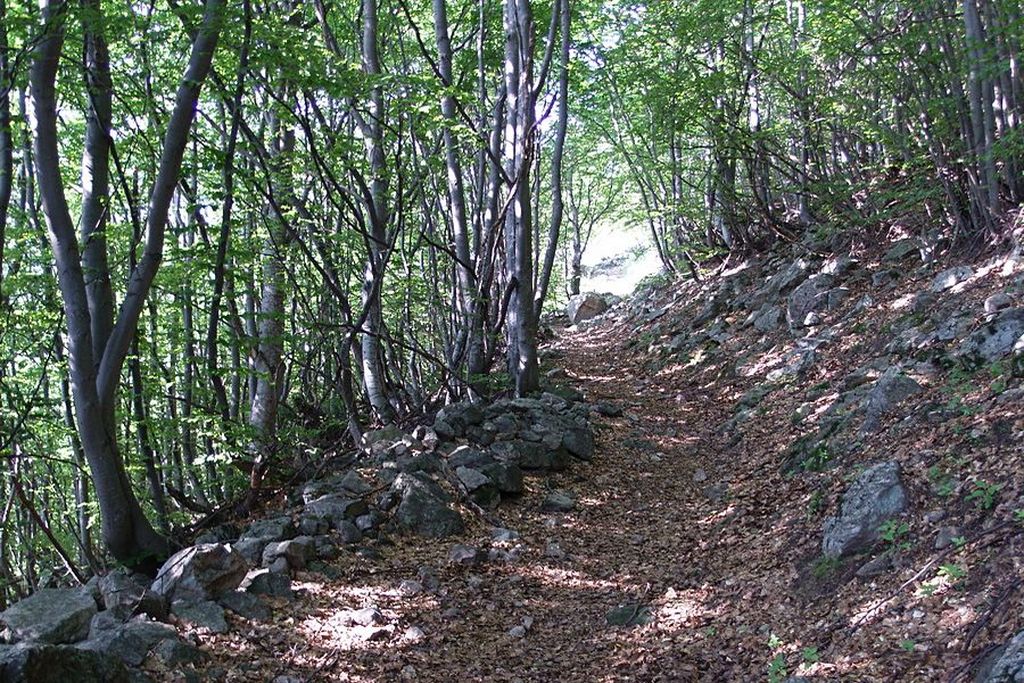
Lower Lake della Valletta
After an initial climb inside cool woods, the surroundings become decidedly alpine; the small lake is formed by glacial moraine deposits, which block off the mouth of the valley.
1 point of interest
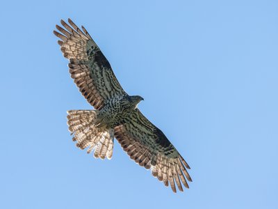
Falco-pecchiaiolo - Giordano Michelangelo  Fauna
FaunaBird migration
Many valleys of the Maritime and Ligurian Alps are the scene, every year, of the migration of tens of thousands of birds which, from Africa to Europe and vice versa, from North to South, move to look for a place to reproduce or to escape the rigors of winter. Many species migrate invisibly to most, but some species of birds of prey gather along the valleys and, taking advantage of the updrafts, move in spring and late summer. Among these, the honey buzzard and the short-toed eagle migrate with very numerous contingents.
Description
From the Pinet parking lot(1428 m) a Parks Service road winds uphill, arriving at a fork near some ruins: take the left fork, which ends soon after and becomes a footpath, leading slightly upwards across the slope of the Vallone della Valletta, through a forest of deciduous trees mixed with larches. Leaving the sparse ruins of the Forest Launa behind on your right, the slope steepens; the path goes over a small stream and, as the deciduous tree are replaced by larches and red spruces, the panorama becomes quite alpine.
After a short downhill tract, the path begins to rise again, crosses another stream and reaches the Ciabot Bacias, a shepherd's camp around which the tall grass sometimes overruns the route. When it emerges again, the path crosses yet another stream and continues, slightly uphill, along midslope of the orographic left of the valley, passing through ample pastures. Then it briefly rises sharply, with a few hairpin turns, leading up to the banks of the broad bed of Lake Sottano della Valletta and a Parks Service hut(1900 m, 1:40 hrs. from Pinet).
Those who want to walk a bit more will find it well worth the effort: a few hundred meters further lies the bottom of the broad, flat depression filled by the lake, and a beautiful waterfall.
- Departure : Pinet (1428 m)
- Arrival : Lower Lake della Valletta (1900 m)
- Towns crossed : Aisone
Altimetric profile
Recommandations
Transport
SNCF line TER Provence Alpes-Côte d'Azur For travel in the PACA region and towards Cuneo www.ter-sncf.com/pac
Trenitalia for travel in the Piedmont region https://www.trenitalia.com/it.html
Access and parking
N.B. The road is restricted. To travel the stretch of road in the Valletta valley that leads to the Pinet area, you must first request authorization from the municipality of Aisone by calling +39 017195751.
The paved road climbs for 3km, then continues on a dirt road for a further 2.7km up to Pinet (keep left at the only fork in the dirt road). Parking available about 300 meters beyond Pinet.
Parking :
Report a problem or an error
If you have found an error on this page or if you have noticed any problems during your hike, please report them to us here: