The Authion's fortress
At the end of the Second World War, the range was defended by entrenched German mountain troops.
On 10th April 1945, the French army launched an assault on the German positions from the south. After a difficult period of combat, the fort of Mille Fourches fell the next day, followed by those of La Forca and Le Plan Caval. The day after, the forts of La Redoute des Trois Communes was stormed.
6 points of interest
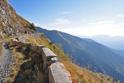
A l'Authion, la piste de la Dea - CEVASCO Jean-Marie  History and historical trail
L'Authion
Glory and exaltation, but also suffering and death. L'Authion has seen the tragic end of many a life.
In April 1794, the Italian army, commanded by Generals Bonaparte and Masséna, fought against Austro-Sardinian troops: after extremely violent battles, L’Authion was taken. The Piedmont road was open to the French!
Then spring 1945 also saw L'Authion’s destiny being determined by more modern weapons. Despite the Operation Dragoon Provence landings in August 1944, the Alpine front, including the advanced post of L'Authion, was solidly held by the German army.On 1st March, General de Gaulle created the Alps Army detachment, which was responsible for defending communication lines.
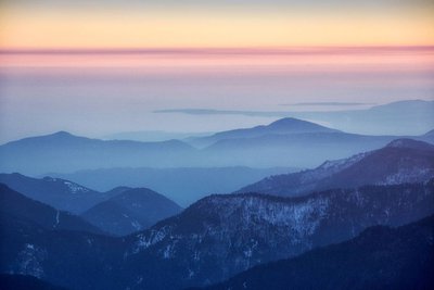
L'Authion - GOURON Claude  History and historical trail
A natural fortress
Authion is a natural fortress which is virtually unconquerable, protected by its immense and steep slopes which "tower 1500m above the valleys of Caïros, Roya and Bévéra".
The relief provides no refuge, no hiding place for attackers who are extremely vulnerable. “You only need a very few men in a dominant position to completely close off access”. (Général Y. Gras).
At the very top, the summits which tower over the 2000m mark are equipped with fortifications which the “the gigantic field work and network of mines” make impregnable.
Just one weak spot: the south!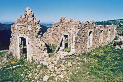
Les ruines de casernement de Cabanes vieilles à l'Authion, (2080 m). - pnm  History and historical trail
22nd March 1945
The order is received “to look into the possibilities of attacking the fortified mountain of L’Authion”. It would be “a powerful frontal attack on L'Authion that two columns, approaching from either side, would take it from behind, one via Col de Raus and the other via Ortighea Giagiabella ".
On 9th April, a general offensive by the Allies was launched on the Italian front. The enemy was to be pinned onto L'Authion.
The weather played its part: snow and mist enveloped L’Authion, forcing everyone to go through the anxiety caused by silence and expectation.
On 10th April, the bombing of the forts by military aircraft formed a brutal wakeup call, France launched an offensive and too the Forca ridge.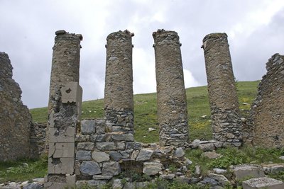
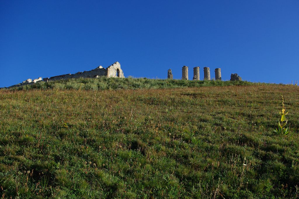
Vestiges militaires en ruine à l'Authion. - Emmanuel GASTAUD  History and historical trail
11th April 1945
At 0300 hours, the Germans counter-attacked and tried, unsuccessfully, to retake the ridge of La Forca and Col de Raus.
At 0800 hours, the French took Cabanes Vieilles and Tête de Vaiercaout and then at 2000 hours the fort of Mille Fourches.
“The fort, lit up by the fire coming out of every opening, has a terrifying appearance... Losses are mounting up, an impression of indecision… We crawl through the mud... The flames shoot out, converging on the caponier which catches fire... We climb onto the roof of the fort...throwing our phosphorus grenades into every ventilation hole. Soon, the whole garrison lines up impeccably”. (Lieutenant-Colonel Lichwitz).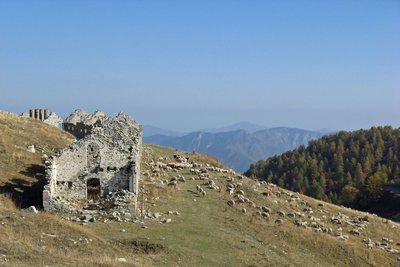
Les ruines des casernements militaires. - Raphaële CHARMETANT  History and historical trail
12th April 1945
L’Authion falls. At 1330 hours, the Fort of La Forca, attacked from Les Mille Fourches is taken with no losses. At 1900 hours the surrounded Fort of Plan Caval surrendered.
La Redoute de la Pointe des Trois Communes remains to be taken: “Barely had the order been given to attack when a tank of naval fusiliers breaks ranks with the others and heads alone and with no infantry towards La Redoute... on its own initiative”. It “slowly climbed up along the hairpin bends. It stopped in front of the drawbridge. A white flag emerged from an arrow slit”.
At 2030 hours, “the conquest of thus came to an end with the bizarre sight of a tank driven by naval fusiliers taking a stronghold at the top of a mountain at 2000m altitude!” (General Y. Gras).
In the Escarène cemetery, a mausoleum was built in memory of the soldiers who fell during the conquest of the fortress of L'Authion.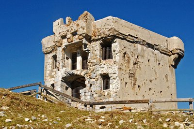
Le fort de la Redoute à l'Authion, (2080 m), à la Pointe des Trois Communes. - Franck GUIGO  History and historical trail
Redoute des Trois Communes
La Redoute des Trois Communes is a French fort which was built in 1898, in the Authion mountain chain under the command of Général Séré de Rivières.
In the 1870s, relations between France and Italy were conflictual. When the Comté de Nice became part of France (24th March 1860), it made Authion even more important as it had become a border chain, the keystone of defending the Maritime Alps. Huge fortification works began to make any possibility of the Italians breaking through impossible. Access to the chain was facilitated by several strategic roads being opened, leading to La Redoute des Trois Communes (1898) and to the forts of La Forca (1883-1890) and Mille Fourches (1883-1890).
Description
At marker 31, take GR52 and follow it as far as Cabanes Vieilles. The view over the Bévéra valley is breath-taking: an entanglement of wooded ridges enshrouded by a light morning mist.
At Cabanes Vieilles, ruined barracks form a reminder of the violence of the combats which took place in 1945. At the parking area, there are information boards.
After you have passed the ridge, the circuit continues through a north-facing larch forest below the fort of Mille Fourches.
Having crossed the Crep mountain stream, the way climbs gently upwards. At a flatter section, the buried fort of Plan Caval watches for hypothetical enemies. Between the ruined barracks, there are deep holes in the ground which are partially blocked by cubes of concrete. Be extremely careful in this dangerous area.
Continue on GR52, climbing up to La Redoute de la Pointe des Trois Communes. From there, continuing along at the same altitude, a path passes by the ruined barracks; it follows the ridge of La Forca, which was an important area during the conflict and arrives at the fort of La Forca. Head down until you are below the fort and turn right towards "La Cabane de Tueis". You will get back to the departure point after the National Park House.
- Towns crossed : Moulinet, Breil-sur-Roya, and La Bollène-Vésubie
Altimetric profile
Recommandations
Information desks
Office de Tourisme Métropolitain - Bureau d'information de Saint-Martin-Vésubie
Place du Général de Gaulle, 06450 Saint-Martin-Vésubie
Horaires
Ouvert toute l'annéeOffice de Tourisme Métropolitain - Bureau d'information de la Bollène-Vésubie
Place du Général de Gaulle, 06450 La Bollène Vésubie
Horaires
Du 01/01 au 31/12, tous les lundis, mardis, mercredis, jeudis et vendredis de 9h à 17h.Fermetures exceptionnelles les 1er janvier, Lundi de Pâques, Jeudi de l'Ascension, Lundi de Pentecôte, 1er mai, 8 mai, 14 juillet, 15 août, 1er novembre, 11 novembre et 25 décembre.
De 9h00 à 12h00 et de 13h00 à 17h00.
Access and parking
From Col de Turini, route 68 rises in zigzags towards Camp d'Argent ski station.
Leave your vehicle at the carpark close to the lodge.Report a problem or an error
If you have found an error on this page or if you have noticed any problems during your hike, please report them to us here:

