Lake Niré
5 points of interest
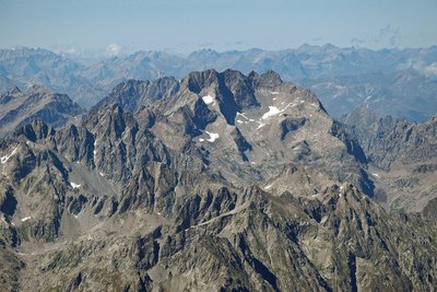
Le Gélas, (3143 m), au mois d'août - GOURON Claude  Geology
Disappeared oceans
During the climb towards the refuge, you will see the summits of recent mountain chains like the Alps.
Glaciers, water, wind and gravity are the agents of erosion which will gradually break down the mountain reliefs and transfer the eroded materials towards the Mediterranean.
In the Maritime Alps, glaciers were the initial agents of active erosion. They have now disappeared and the erosion continues die to mountain streams and rivers which wear away the floors of valleys, the cycles of freezing weather followed by thaws which crack the rocks and the effects of gravity on the steepest slopes.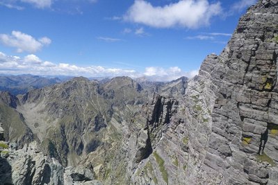
Les parois très abruptes du versant Gordolasque du Grand Capelet, (2925 m). - GUIGO Franck GeologyThe Gordolasque valley
The western flank of Grand Capelet and the steep high peaks overlook the itinerary to the Nice refuge and Lac Niré. This wild glacial cirque is characteristic of the rapid and intense erosion during the last period of glaciation. 20000 years ago, glaciers covered all of the valley and then hollowed out the Gordolasque valley into the shape of a trough. Today, there still remains evidence of glacial erosion along the itinerary: immense smooth slabs on which you walk at times were smoothened by this phenomenon.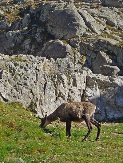
Chamois (Rupicapra rupicapra) près du refuge de Nice en Gordolasque à la fin de l'été - MALTHIEUX Laurent  Fauna
FaunaChamois (Rupicapra rupicapra)
A mammal of the Bovidae family and the subfamily of the Caprinae, the chamois (Rupicapra rupicapra) is a mountain dweller par excellence. It can climb 1000m upwards in 15 minutes (a hiker would take 3 hours). It can be recognised thanks to its horns, which are straight and then curved backwards, and quite small compared to those of the ibex.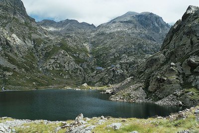
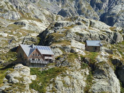
En Gordolasque, le lac de la Fous et le refuge de Nice - LE BOUTEILLER Eric  History and historical trail
The Salt Road
The track which leads to the Nice refuge is one of the secondary passages of the Salt Road via the “Pas de Pagari”. Frequented since ancient time, this Pas gets its name from Paganino dal Pozzo,an Italian entrepreneur who, in 1453, was appointed as salt tax adjudicator by the Duke of Savoie.
Paganino was responsible for the construction of a new route via the “Pas de Pagari” to transport salt from Provence to Cuneo in Piedmont.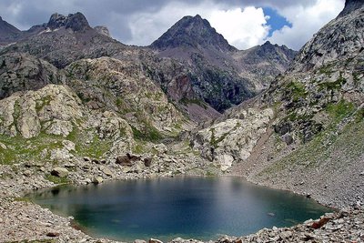
Le lac Niré, (2353 m), et la cime de Chamineye, (2921 m), le 29 septembre 2006, - GUIGO Franck GeologyThe eclogite of Lac Niré
Just above Lac Niré, on the right bank of the mountain stream, among the migmatite, can be found very dark rocks which take the shape of huge lentils (geologists call them “black puddings”).
When you look closely at these one of these lentil, you can see very different minerals to the ones you find in migmatite. The rusty red coloured ones are garnet and the darker ones are amphibole.
This very distinctive rock with characteristic fine and very dense crystals is eclogite; it is quite rare and a remainder from oceans which have disappeared. It is a metamorphic rock which springs from the transformation of basalts, ancient lava from the oceanic crust.
Description
From Countet Bridge (marker 411), take the path which runs alongside the Gordolasque mountain stream. On the right, the Grand Capelet (2935m) towers over the valley with its imposing bulk and the Tête du lac Autier (2740m) with its flat summit shows the way to go.
You will then go past a heap of big blocks which have fallen from the mountain, an ideal terrain for climbers.
At marker 413, note the glacier cliff and its smooth rocks which the mountain stream flows over in waterfalls. Cross the river via the wooden footbridge and climb up the opposite bank. Follow the Autier mountain stream until marker 414. At the marker, take a left turn and climb over the Mur des Italiens.
Keep climbing amid this more chaotic and rocky scenery until you reach the dam of the Lac de Fous, which was built in 1968 (marker 416).
Head right on the GR52 which runs alongside the artificial lake and lead to the Nice refuge (marker 417). Continue towards "Baisse du Basto".
At marker 418, cross the mountain stream and start climbing the Niré valley until you reach Lake Niré (2350m), which is aligned with the summit of the same name.
Follow the same route for the return journey.
- Departure : Countet Bridge, marker 411
- Arrival : Countet Bridge, marker 411
- Towns crossed : Belvédère
Altimetric profile
Recommandations
Information desks
Maison du Parc national du Mercantour - Saint-Martin-Vésubie
8, Avenue Kellermann - Villa Les Iris, 06450 Saint-Martin-Vésubie
Horaires
Ouvert tous les jours sauf le dimanche du 15 juin au 15 septembre
Office de Tourisme Métropolitain - Bureau d'information de Belvédère
Rue Victor Maurel, 06450 Belvédère
Horaires
Ouvert toute l'annéeOffice de Tourisme Métropolitain - Bureau d'information de Saint-Martin-Vésubie
Place du Général de Gaulle, 06450 Saint-Martin-Vésubie
Horaires
Ouvert toute l'annéeAccess and parking
Parking :
Report a problem or an error
If you have found an error on this page or if you have noticed any problems during your hike, please report them to us here: