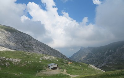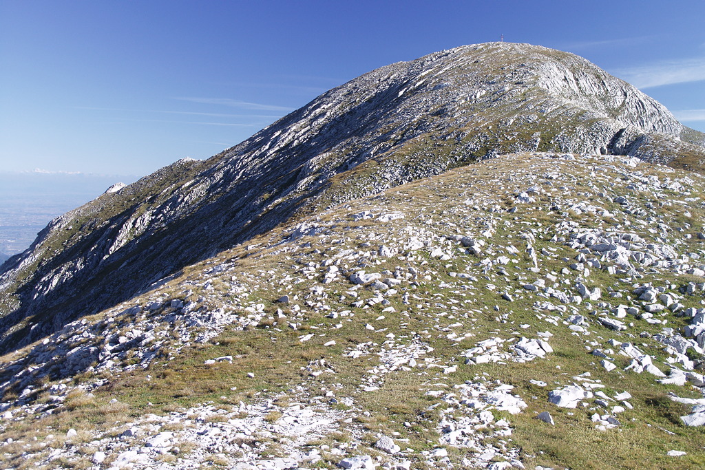
Il Rifugio Don Barbera e Punta Marguareis
Highlights of this ascent include the traditional architecture of the villages of Carnino and the rugged Chiusetta Gorge. Beyond the gorge, a karst landscape reappears, featuring arid slopes, lakes that have turned into peat bogs, and pastures. The view from the summit of Marguareis is majestic; it’s best to reach the summit early in the morning to avoid the frequent cloud formations typical of the area.
1 point of interest
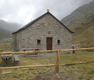
La Cappella-Rifugio di Sant'Erim - Archivio EAM  Architecture
The Chapel of Sant'Erim and the Selle Refuge in Carnino
The Chapel of Sant'Erim (Chapel of Sant'Elmo) was built following the saint's apparitions here to groups of shepherds. Tradition has it that a mass was celebrated here every year on the day the cattle went up to the mountain pastures.
The Rifugio Selle di Carnino was built from a shepherds hut by the Ligurian Section of the CAI . It was used until the Second World War when it was seriously
damaged and definitively abandoned.
[A. Parodi, R. Pockaj, A. Costa - Nel cuore delle Alpi Liguri, collana Sentieri e Rifugi, Andrea Parodi Editore, 2012, p.42]
Description
From the parking lot at the base of Carnino Superiore (1384 m), you enter the beautiful village, following the mule trail that leads westward out of it. Ignore the fork to the left for Passo Lagarè and continue along the trail that enters the Carnino Valley.
The winding trail winds along sun-drenched slopes; after passing a welcome fountain, the trail cuts across the left side of the valley, leaving the fork for Passo delle Mastrelle on the right, then traverses at the base of several rock outcrops and reaches the narrow gorge of Gola della Chiusetta (1811 m, 1 hour 20 minutes from Carnino Superiore).
This narrow passage, which provides access to the Vallone dei Maestri, leads to a first pasture clearing, followed by a second, much wider one.
The meadow, home to the recently renovated Selle di Carnino alpine pasture, the ruins of the Selle di Carnino Mountain Hut, and the Chapel of Sant’Erim, is reached from above by an agricultural and pastoral trail coming from the Don Barbera Mountain Hut.
Ignoring the trail and keeping to the right of the buildings, take the path that runs along the orographic left side of the valley.
With a long diagonal stretch through pastures and rocky outcrops, the trail slowly gains elevation, passes the turnoff to Colle del Pas on the right, and finally, after a short steeper section, reaches the Don Barbera Mountain Hut (2079 m, 1:05 hours from the Gola della Chiusetta).
On the east side of the shelter, beyond the wooden fence, follow the trail markers pointing north across the meadows. The trail enters a distinctive stretch of limestone rocks and is joined on the left by another trail coming from Colle dei Signori.
Once you emerge from this rugged rocky section, the trail climbs fairly steeply through scree and sparse grass to Colle della Gaina (2357 m, 50 minutes from the Don Barbera Mountain Hut).
At the barely marked pass, you’ll come to a fork: leave the trail on the left that follows the ridge line (the shorter but more challenging route) and descend to the right.
The ascent resumes shortly afterward, through sparse grass and small rocks, and leads to an unnamed pass (approximately 2500 m), where you’ll come to a fork. Continue to the left, still climbing, up the easy final slope that leads to the summit of Punta Marguareis (55 minutes from Colle della Gaina).
- Departure : Carnino superiore (1384 m)
- Arrival : Punta Marguareis (2651 m)
- Towns crossed : Briga Alta and La Brigue
Altimetric profile
Access and parking
From Ceva, drive up the Tanaro Valley to Ponte di Nava, where you take the right fork toward Viozene, Carnino, and Upega. Before the bridge over the Rio Carnino, you’ll find the turnoff to the right for Carnino, and you’ll drive up to the village of Carnino Superiore.
Report a problem or an error
If you have found an error on this page or if you have noticed any problems during your hike, please report them to us here: