
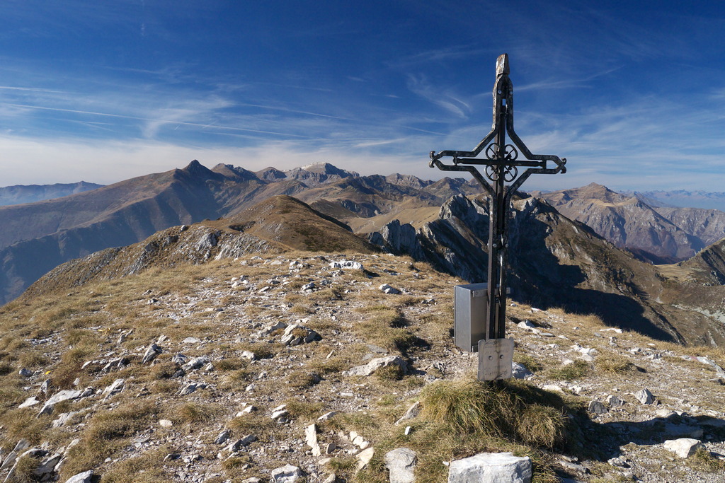
Il Rifugio Savona e Monte Antoroto
One of the last Alpine peaks over 2,000 meters, which can be reached after passing through beech forests, pastures, and alpine meadows. The panoramic views from the summit are vast, stretching from Liguria and the Mediterranean to the entire Alpine arc.
Description
The route begins in Valdinferno (1205 m), at the foot of the parish church. Follow the narrow concrete road as it climbs at a moderate gradient. Ignoring all side roads, take the trail that branches off to the right at an elevation of about 1280 (signpost marked “Scorciatoia” and very faded directions painted on the concrete wall beside the road). The trail climbs through the woods to Case Bosso (1366 m, fountain), where it rejoins the concrete road.
Turn right and follow the road to Case Mulattieri (1407 m, 0:35 hours from Valdinferno, fountain).
Here, behind the fountain, ignore the first fork to the right leading to the Savona Mountain Hut. A short distance further on, the road becomes a dirt road, and you’ll come to a second fork; take the right fork toward the Savona Mountain Hut (signpost marked “Scorciatoia”).
Pass above a few houses in the hamlet and you’ll soon reach a four-way intersection where you take the first trail on the right. The trail enters the beech forest and turns right (northeast); near a ruin, turn left and continue climbing through meadows dotted with patches of beech trees.
Once you reach Pian Bersi, take the dirt trail and follow it to the left.
Ignore the various branches to the left (one marked for Monte Antoroto) and you’ll arrive at the Savona Mountain Hut (1588 m, 0:35 hours from Case Mulattieri).
Behind the refuge, take the trail on the left toward Colla Bassa and Monte Antoroto.
You’ll traverse sun-drenched pasture slopes, just skirting the beech forest below; the trail, which at times merges with the tracks of grazing animals, crosses a marshy area, then crosses the small Rio dei Fusi stream, and finally climbs more steeply up open slopes to the rocky ridge branching off from Monte Grosso, where the pass known as Passo della Capretta opens up (1744 m, 0:35 hours from the Savona Mountain Hut).
Descend the opposite slope, which is quite steep, along a narrow trail. Once at the bottom of the valley, climb back up the slopes of Monte Grosso via a long traverse. Upon reaching a small plateau near a huge, rounded boulder, join the direct trail coming from Case Mulattieri.
Turn right, and in a few minutes you’ll reach Colla Bassa (1851 m, 0:30 hours from Passo della Capretta), which connects two side valleys of the Tanaro Valley and the Casotto Valley.
At the pass, take the trail on the left that climbs up the north face of Monte Antoroto.
The trail curves slightly to the right, cutting across the mountainside: the ascent, through low shrubs, is steep and strenuous. Once you reach the saddle at the base of the summit’s western ridge, turn left (east).
The ascent now continues across gentle grassy slopes with much gentler gradients; a final short flat stretch along the ridge line finally leads to the summit of Monte Antoroto (2149 m, 0:50 hours from Colla Bassa).
- Departure : Valdinferno (1205 m)
- Arrival : Monte Antoroto (2149 m)
- Towns crossed : Garessio and Ormea
Altimetric profile
Access and parking
From Ceva, drive up the Tanaro Valley to Garessio. A few hundred meters past Garessio, turn right toward Valdinferno. Parking is available for a few cars.
Report a problem or an error
If you have found an error on this page or if you have noticed any problems during your hike, please report them to us here: