Il Colle del Pas e Cima Pian Ballaur
A very interesting and varied route that allows you to observe up close—sometimes by veering slightly off the trail—many typical features of karst phenomena, as well as erratic boulders and mysterious menhirs. The small Lake Rataira is beautiful, and the climb to Cima Pian Ballaur is well worth the effort; it’s not very crowded simply because it’s a few dozen meters lower than the surrounding peaks—yet the view it offers is remarkable and stretches all the way to the sea.
1 point of interest
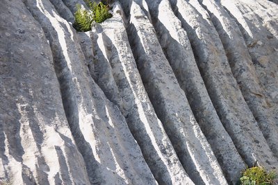
Fenomeni erosivi su rocce calcaree - Roberto Pockaj  Geology
The furrowed fields
The 'furrowed fields' (also called 'carried fields' due to the shapes that vaguely recall the furrows left by the wheels of carts in the mud) are erosion phenomena typical of limestone rocks, due to the runoff of rainwater.
Description
From the Pian Marchisio Pass (or Pian Marchisa, 1,634 m), follow the dirt road that descends into the wide pastureland of Pian Marchisio and continues for a long stretch on level ground alongside the Ellero Stream.
After two hairpin turns (bypassed on the left by short shortcuts), the dirt road gains elevation, then meets the trail on the right that leads directly to the mountain hut.
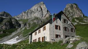
After crossing an agricultural and pastoral trail, the path climbs up undulating grassy slopes to the Mondovì - De Giorgio Mountain Hut (1,761 m, 0:45 hours from Porta di Pian Marchisio).
The trail continues behind the refuge and winds uphill through rhododendrons along the spurs of Punta Havis De Giorgio. After rounding the ridge, you enter the small valley of the Rio Ciappa, encountering a short stretch of paved trail that crosses an otherwise marshy area. Upon reaching the base of the rock face at the head of the valley, the trail begins a steep ascent with wide switchbacks that gradually narrow until reaching Porta Biecai (2,004 m, 0:50 hours from the Mondovì Mountain Hut), on the edge of the basin of Lake Biecai (usually dry in summer).
Circle the basin from above, heading to the right, and stay halfway up the slope. Pass a trail on the left leading to the lake and, a short distance further on to the right, the fork leading to Lago delle Moie. After a steep climb up a grassy slope, you reach a grassy plateau and another (barely visible) fork, where you take the left branch, which is less well-defined. You pass at the base of a rocky outcrop shaped by glacial action; beyond it, the trail becomes less visible and climbs through meadows, rhododendrons, and exposed rocks.
You pass the ruins of a mountain hut nestled against a boulder, then continue winding your way along the trail, following the sparse trail markers. The more prominent trail from Porta Sestrera joins from the right, and, turning left, you emerge on the shores of the picturesque Lake Rataira (2,204 m, 0:50 hours from Porta Biecai).
Beyond the lake, you reach the base of the final slope and climb it via a fairly steep traverse that leads to Colle del Pas (2,349 m, 0:25 hours from Lake Rataira).
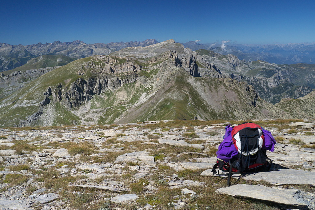
At the pass, take the clearly visible little trail to the left (east), which follows the ridge perfectly but disappears as soon as the narrow watershed widens significantly. However, a series of stones embedded in the ground, interspersed with sparse trail markers bearing now-faded yellow notches, easily guide you along the broad ridge: among schistose rocks and sparse grass, climb while staying slightly to the left of the ridge. Upon reaching a sort of saddle, where the ridge forks, turn right, continuing to follow the watershed to the flat summit of Cima Pian Ballaur (2,603 m, 0:45 hours from Colle del Pas), where the view stretches in all directions.
- Departure : Pian Marchisio (1634 m)
- Arrival : Cima Pian Ballaur (2603 m)
- Towns crossed : Briga Alta
Altimetric profile
Access and parking
From Villanova Mondovì, drive up the Ellero Valley to Roccaforte Mondovì. Then turn left toward Rastello, where you’ll take the “Pian Marchisio forest road.” The road climbs for over 4 km—partly paved and partly unpaved (vehicles with high ground clearance are recommended)—until you reach the Porta di Pian Marchisio.
Report a problem or an error
If you have found an error on this page or if you have noticed any problems during your hike, please report them to us here: