
Les forts du Col de Tende
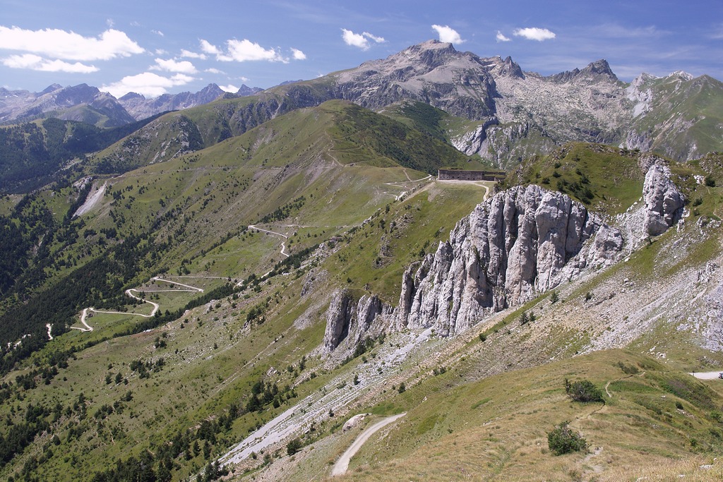
Beautiful spring flowers, with panoramas that span the Maritime Alps, the Ligurian Alps and down to the sea. And then a plunge into history, with the imposing fortifications of the late nineteenth century, part of the entrenched camp of Tenda, built by the recently formed Kingdom of Italy to defend its borders.
2 points of interest
Il Forte Centrale - Roberto Pockaj  History and historical trail
The Central Fort
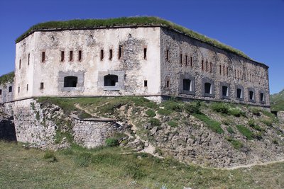
Fort Central (so renamed even if its original denomination was Forte Alto, which later became Forte Colle Alto), the fulcrum of the Colle di Tenda defensive system, was armed with 10 cannons, two mortars and 4 machine guns. Completed in 1880, Fort Colle Alto was flanked by an imposing defensive barracks capable of accommodating about 300 men. It also had stables, various logistic services (infirmary, warehouses, ammunition depots), and was connected to the valley floor with a cableway that went up from Panice sottotana, capable of supplying the fort even in case of snow on the roads.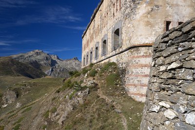
La Rocca dell'Abisso dal fronte d'attacco del Fort Central - Roberto Pockaj History and historical trailThe Entrenched Camp of the Colle di Tenda
The Entrenched Camp of the Colle di Tenda - d045f31
The forts belonging to the Colle di Tenda camp (Colle Alto, Margheria, Pepino, Taborda, Giaure and Pernante), built between 1877 and 1888, with great expenditure of energy and financial resources, became obsolete within a few years because of the progress of artillery and shells. Active until the beginning of the First World War, when they were disarmed to take artillery to the Austrian front, in the Second World War they were all relegated to stores and ammunition dumps, and sometimes to shelter troops; they were replaced by more modern concrete constructions forming part of the "Vallo Alpino" defensive system. This territory passed to the French following the peace treaty of 1947, and their original Italian denomination was changed.
[Dario Gariglio and Mauro Minola - Le Fortificazioni delle Alpi del Mare - L'Arciere Ed., Pp.35-38]The Fort Central - d163f43
Fort Central (thus renamed even though its original name was Forte Alto, which later became Forte Colle Alto), the fulcrum of the defensive system of Colle di Tenda, was armed with 10 cannons, two mortars and 4 machine-guns. Completed in 1880, the Forte Colle Alto was flanked by an impressive defensive barracks able to accommodate about 300 men. It also had stables, various logistic services (infirmary, stores, ammunition deposits), a cableway connected it to Panice sottana in the valley to supply the fort even in the roads were snow-bound .
[Dario Gariglio and Mauro Minola - Le Fortificazioni delle Alpi del Mare - L'Arciere Ed., Pp.35-38]
Description
From Colle di Tenda (1871 m) walk up to the nearby Fort Central (formerly Forte Colle Alto, 0:15 mins from Colle di Tenda).
On the far side of the fort, drop down to the dirt road that connects the Colle di Tenda with Monesi and follow it to north-east on the flat, for over 500 meters, to Col de Cannelle (1874 m, not named on Italian maps).
At the pass, where the dirt road forks, take the trail between the two roads that climbs very steeply along the ridge.
The trail, which splits at times on both sides of the watershed—though the left branch, which ascends in switchbacks, is preferable—offers beautiful views of the nearby Colle di Tenda and the Maritime Alps.
After a long climb, you pick up the old military mule track coming from Fort Tabourde and follow it to the left. The mule trail makes two turns and then, after a short flat stretch, leads to the barely noticeable Col de la Vallette pass (or Col Vallette, which is also not named on Italian maps, 2,187 m, 1 hour and 10 minutes from Col de Cannelle).
The pass is a small crossroads: ignoring the side roads and shortcuts, continue along the former military mule trail toward Fort Pepin.
After numerous hairpin turns, ignore the left fork leading to Colle della Perla and continue to the right: the old dirt road cuts across the slopes of Cime de Pepin and, after a long, scenic stretch along the hillside, descends to Fort Pepin (formerly Forte Pepino, 2263 m, 0:35 hours from Col de la Vallette).
Return along the same route back to Col de la Vallette; descend again along the route taken on the way up and cross the flat meadow section once more. On the return trip, however, stay on the former military mule track at all times, leaving the trail used for the ascent on your right. The mule track descends with a few switchbacks, then begins a very long downhill traverse toward the south.
Near the fort, it makes a few more switchbacks and joins the dirt road coming from Col Cannelle. Following the dirt road to the left, you’ll soon reach Fort Tabourde (formerly Forte Taborda, 1982 m, 1 hour 15 minutes from Fort Pepin).
After retracing your steps briefly, follow the access road to the fort all the way; here too, the dirt road makes a long, gently descending traverse and reaches Col de Cannelle (1874 m, 0:35 hours from Fort Tabourde).
At the pass, you rejoin the Colle di Tenda–Monesi road, which you follow to the left. Follow the route you took on the way there in reverse, and climb the ramp to the left toward Fort Central. At the first fork, keep to the right, cross the enormous Central Defensive Barracks, and, once you’ve left the ruins of the complex, descend to Colle di Tenda (1,871 m, 0:30 hours from Col de Cannelle).
- Departure : Col de Tende (1871 m)
- Arrival : Col de Tende (1871 m)
- Towns crossed : Limone Piemonte and Tende
Altimetric profile
Access and parking
From Borgo San Dalmazzo travel up the Vermenagna Valley towards Limone Piemonte. Before reaching the Tenda tunnel, turn right to Limone 1400 (Panice soprana) and from here continue to Colle di Tenda. Parking spaces are available for many cars.
Report a problem or an error
If you have found an error on this page or if you have noticed any problems during your hike, please report them to us here: