4. The Wolf Trail - Argentera & Mercantour - Stage 4
11 points of interest
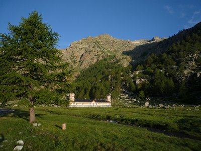
Deux gardes moniteurs de la Vésubie sur le toit de la vacherie de Salèse sous la neige, entourée de forêts. - RIFFLET François  Small heritage
Cow barns
This element of the community system allowed the inhabitants of the valley to place their cows into the charge of a guardian who would be responsible for them as they enjoyed the high-altitude pastures in summer. Mountain dwellers were thereby free to participate in the hay cutting and other agricultural activities close to the villages.
The cow barns which you can see on the Erps and Le Cavalet circuit were temporarily used during the summer, which explains why they are small. Today, only two farmers still work on the site of Boréon, owning or hosting thirty or so cows each.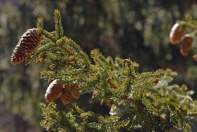
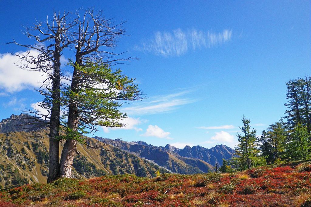
Les cônes d'un épicéa - F. Guigo  Flora
FloraConifers
These resinous trees, with leaves shaped like needles or scales, produce conical fruits, hence the name given to this group. The larch is the only conifer which loses its needles in the winter. They are grouped together in clumps of 15 to 20. This species is only present in the Alps. It can also be found at the upper limit of the forest as it needs light to develop.
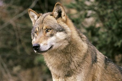
Portrait de loup d'Europe, (Canis lupus lupus). - JOULOT Christian  Fauna
FaunaWolf (Canis lupus)
In 1992, wolves came back into this area of their own accord, crossing the border from Italy, but they remain very secretive in the park.
They live in packs of 4 to 6 individuals, each pack having a territory which covers some 200 to 300 km².
Its diet is highly varied, mainly eating wild ungulates (mouflons, chamois, wild boar, deer) in addition to domestic ones (sheep), but it also eats small rodents, birds, insects and vegetal matter (wild berries, mushrooms,...).
Its role as a regulator of wild fauna needs to be underlines. This species is protected by national and international regulations and it has a natural place in the food chain and the ecosystem.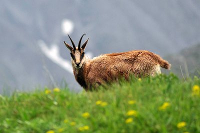
Un chamois - P. Pierini FaunaChamois (Rupicapra rupicapra)
A mountain dweller par excellence, the chamois can climb 1000m upwards in 15 minutes (a hiker would take 3 hours). It is easy to spot. The population of chamois is high and it roams along the mountains, from the forests and grasslands to the peaks.
It can be recognised thanks to its horns, which are straight and then curved backwards, and quite small compared to those of the ibex. Its forehead and cheeks are white, separated by two black bands from its ears to its muzzle.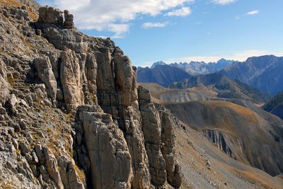
Panorama sur la chaine transfrontalière Argentera-Mercantour depuis les barres du Mont Mounier, (sommet à 2817 mètres). - PIERINI Philippe  Geology
Argentera granite
If you look closely at this grey rock, you will see that it is made of different minerals. Quartz (grey) and feldspar (white) sometimes big with a few sparkling areas here and there on the rock. This is black mica and more specifically biotite.
You have discovered blocks of granite. All the minerals it is made up of are contiguous and visible with the naked eye. The texture is igneous, characteristic of plutonic rocks which crystallised deep in the earth.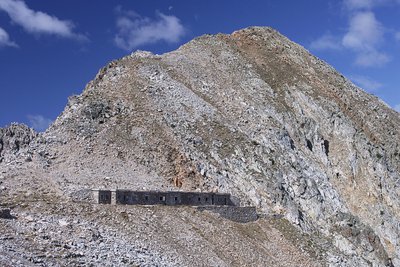
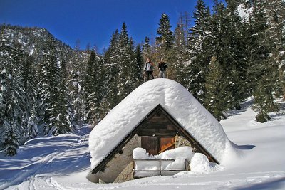
La Casermetta difensiva Colle Fremamorta e la Cima di Fremamorta - Roberto Pockaj  History and historical trail
The Cima di Fremamorta barracks
The barracks building is an imposing structure and is still in relatively good condition: The camouflage paint on the doors is still visible, and there are a good number of windows and doors left, outside and inside. Outside, there are traces of the open-air kitchen, used by the troops during the warm months. The barracks could house a garrison of 60.
Along the last stretch of uphill trail, as well as in the nearby Val Morta, there remain a few telephone poles in larch, on which were strung the wires for communications between defensive outposts.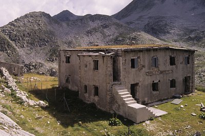
Il ricovero Umberto I - Roberto Pockaj History and historical trailThe Umberto I shelter
This is in fact a large barracks, designed to house 130 soldiers and 4 officers. Built in 1894, it was readapted on three separate occasions, the last of which in 1934, when another section was added on one side of the main building to house the kitchen, and a freestanding structure was also erected. The ruins of an old storage barn and stables can be seen just above the barracks.
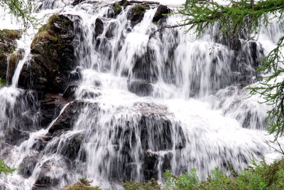
La cascata all'imbocco del Pian del Valasco - Roberto Pockaj GeologyThe Pian del Valasco waterfall
The mass of rocks over which the water falls is a typical example of a glacial rock step. During the glaciations it formed the lower limit of the lake at the foot of the glacier. A tongue of the glacier extended beyond the step.
Il Lariceto - Cati Caballo FloraThe larch
This type of forest is rather localized in the Maritime Alps, which notoriously represent the realm of the beech forest. It covers the slopes at the heads of the valleys with sparse and luminous populations, sometimes grazed by the herds that have climbed the mountain pastures. Most of the time their purity is not natural, but induced by man: in fact, over the centuries, man has favored this tree species to the detriment of others, such as the stone pine, for example, because they are less favorable for exercising the grazing due to the increased shading of the soil.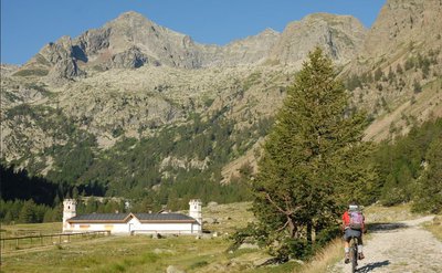
Tête du Claus (2897m), surplombant le refuge de Valasco en été - A. Rivelli / PNAM History and historical trailRefugio Valasco, former hunting lodge
This is where King Victor Emmanuel II of Italy had a hunting lodge built, a singular “castle”, square in shape and with a crenelated tower. It has since been transformed into a high-altitude refuge, much to the delight of hikers.
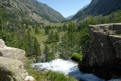
From the Valasco plateau where the refuge is located, you can easily reach the area of the Valascura lakes, heading along the magnificent road built by hunters in the early 20th century. Part of the road is paved, allowing you to go through an area which is littered with boulders and debris.
A mule track leads to the panoramic col of Valmiana.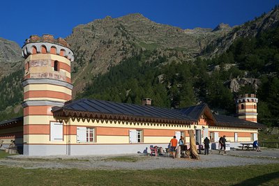
Il Rifugio Valasco - Roberto Pockaj History and historical trailThe Valasco Royal Hunting Lodge
The construction of a "Country House" in Vallasco, which Vittorio Emanuele II would later utilize for his hunting parties in the Royal Reserve, dates back to the years after 1868, when there were probably four buildings standing on the plateau. However, the Royal Hunting Lodge, at least the one we admire today, was probably built after 1873, although sources differ on this.
Its history has been turbulent, and marred by a series of fires until, following an important restructuring by its current owner, in 2008 it was transformed into an alpine refuge.
Description
- Departure : Boréon
- Arrival : Valasco refuge
- Towns crossed : Saint-Martin-Vésubie, Valdeblore, and Valdieri
Recommandations
Report a problem or an error
If you have found an error on this page or if you have noticed any problems during your hike, please report them to us here:
Close by2
- Mountain Hut
Mountain Hut
Rifugio Valasco
At the center of the Valasco plateau stands the beautiful Palazzina Reale di Caccia, commissioned by Vittorio Emanuele II for his chamois hunting and for some years now it has become an accommodation facility.
The Valasco Refuge, in the heart of the Alpi Marittime Park, stands at 1764 m in Valle Gesso, Terme di Valdieri (CN).