4. Giro del Marguareis, stage 04: from Rifugio Mongioie to Rifugio Don Barbera
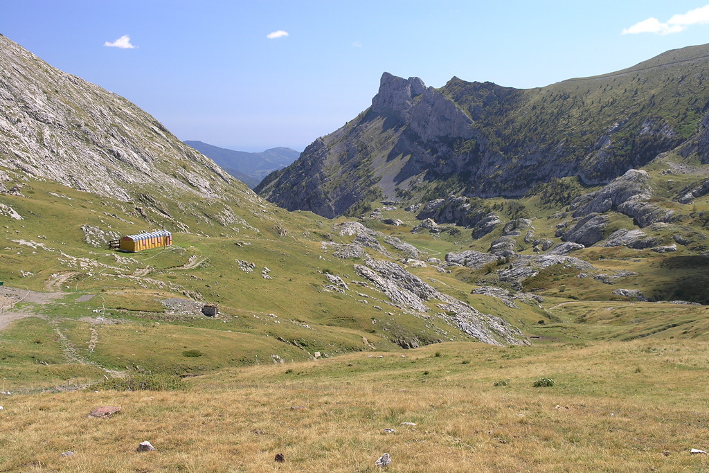
After crossing pastures and pine woods, beyond Gola della Chiusetta you are back in a high mountain setting, with scenery typical of a karst environment, dry slopes, lakes transformed into peat bogs and pasture. To note in particular is the typical architecture of the hamlets around Carninopendii aridi, laghi trasformati in torbiere e pascoli. Da notare l'architettura tipica delle borgate di Carnino.
1 point of interest
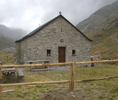
La Cappella-Rifugio di Sant'Erim - Archivio EAM  Architecture
The Chapel of Sant'Erim and the Selle Refuge in Carnino
The Chapel of Sant'Erim (Chapel of Sant'Elmo) was built following the saint's apparitions here to groups of shepherds. Tradition has it that a mass was celebrated here every year on the day the cattle went up to the mountain pastures.
The Rifugio Selle di Carnino was built from a shepherds hut by the Ligurian Section of the CAI . It was used until the Second World War when it was seriously
damaged and definitively abandoned.
[A. Parodi, R. Pockaj, A. Costa - Nel cuore delle Alpi Liguri, collana Sentieri e Rifugi, Andrea Parodi Editore, 2012, p.42]
Description
From the Rifugio Mongioie (1550 m) take the dirt road to the west. Ignore a dirt track to the right and a little further on, leave the road to take the path to the right towards Carnino Inferiore.
The trail continues for a long time on a slight slope and, ignoring a turning on the left for Viozene, climbs to a junction: on the right the trail for Grotta delle Vene branches off, straight (recommended) takes you to the suspended bridge over the river which flows in the Vallone delle Fuse.
A final uphill traverse reaches the Colla di Carnino (1594 m, 1:00 hours from the Mongioie Refuge). Drop down the opposite side of the pass on a wide path that, near the ruins of Tetti delle Donzelle (1516 m, 0:15 mins from Colla di Carnino), you enter the dirt road coming from Carnino Inferiore.
Follow it to the left and leave it after the second bend to the right: here take the path that breaks off to the left, dropping down quite steeply, crosses the dirt track again lower down, then curves east contouring across the hill to Carnino Inferiore (1359 m, 0:15 mins from Tetti delle Donzelle).
Weaving through the narrow streets of the village you arrive at the surfaced parking area lower down.
Follow the dirt road that leads off to the north-west, leaving it immediately to turn left onto a bridge and take the easy track that goes up to the car park at Carnino Superiore (1384 m, 0:10 mins from Carnino Inferiore).
You cross the village, ignore the junction on the left for Passo Lagarè, and enter the Vallone di Carnino.
The winding path turns along sunny slopes; after passing a fountain, the path cuts across the side of the valley, leaving the junction for Passo delle Mastrelle on the right and reaches the narrow gully of the Gorge della Chiusetta (1811 m, 1:20 hours from Upper Carnino).
The narrow passage, which brings you to the Vallone dei Maestri, leads to a first flat pasture, followed by a second, wider one, site of the recent pasture of the Selle di Carnino and the Chapel of Sant'Erim. Keeping to the right
of the buildings, stay on the path that with a long diagonal through pastures and rocks slowly gains altitude, ignore a fork to the right for the Colle del Pas and finally, after a short steeper stretch, you come to Rifugio Don
Barbera (2079 m, 1:05 hours from the Gola della Chiusetta).
- Departure : Rifugio Mongioie (1550 m)
- Arrival : Rifugio Don Barbera (2079 m)
- Towns crossed : Ormea and Briga Alta
Altimetric profile
Recommandations
Report a problem or an error
If you have found an error on this page or if you have noticed any problems during your hike, please report them to us here:
Close by2
- Mountain Hut
Mountain Hut
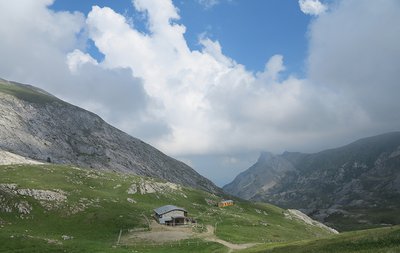
Rifugio Don Barbera
The current structure, in stone and wood, is the result of a complete renovation recently carried out. It is a comfortable refuge, suitable for hikers as well as for groups and schools.
The refuge is located a few meters from the Colle dei Signori, immersed in the austere and uncontaminated nature of the upper Pesio and Tanaro valley natural park. - Mountain Hut
Mountain Hut
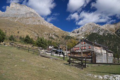
Rifugio Mongioie
Located on the large plateau (Pian Rosso) above the town of Viozene, the Mongioie refuge is the ideal starting point for excursions at high altitude.
The Mongioie massif (2630m) slopes down towards the refuge with spectacular limestone formations up to 350m high where you can climb beautiful rock.
In addition, there are many activities related to the mountain accompanied by typical and seasonal cuisine.