3. Giro del Marguareis, stage 03: from Rifugio Mondovì to Rifugio Mongioie via Passo delle Saline
Description
Follow the dirt road to the Mondovi Havis De Giorgio Refuge back down. After a short while the road forks, take the right branch. The road continues for a long time on the flat, fording the watercourse in the valley bottom twice.
Just beyond the Gias Pra Canton, the dirt road climbs a rocky outcrop to a fork on the right with the path to Passo delle Saline.
Once you have taken the path, it leads to a plateau above. Signpost posts lead through meadows and outcropping rocks. Now the path runs through Alpine meadows(more marker posts) bends to the right and climbing to a grassy knoll.
Climb the steep slope (inopportune shortcuts) that leads to Passo delle Saline (2177 m, 1:40 hours from Rifugio Mondovì).
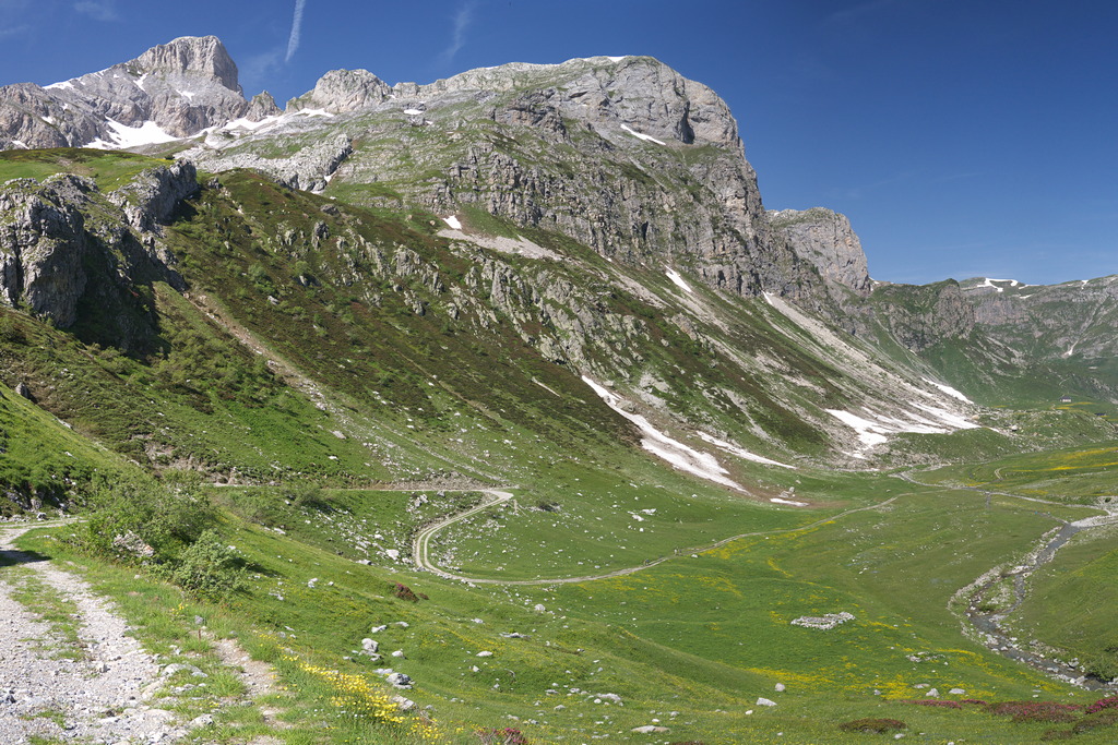
At the pass two paths are ignored: to the right for Cima delle Saline and to the left for Mongioie, it gets rather steep as you drop down into the Vallone delle Saline, between rounded slopes and pastures. Beyond the restored Gias delle Saline the landscape changes drastically.
In fact you are closed in by steep limestone walls, as you enter the narrow Gola delle Saline, which is overcome by crossing to the left (facing downhill).
Outside the gorge you cut down a debris slope, then, entering the wood, you leave the short detour to the Rifugio Ciarlo Bossi (1526 m) on the right.
A little further on you reach the ruins of Tetti delle Donzelle (1516 m, 1:10 hours from Passo delle Saline).
At the junction near the ruins, turn left onto the wide path that reaches the Colla di Carnino (1594 m, 0:15 mins from Tetti delle Donzelle) through a beautiful pine forest.
Continue on the opposite side of the modest pass, over flattish ground and slight slopes, and pass the stream that flows into the Vallone delle Fuse by a suspension bridge (if not in use, use the path on the left just before the bridge).
After a few turns down hill you start to traverse again. Ignore the path on the right for Viozene and climb slowly: leaving the forest and continue on flat ground on a sunny ridge. Once you reach the wide Pian Rosso plateau, you get onto a dirt road; following it to the left you reach Rifugio Mongioie (1550 m, 1:00 hour from Colla di Carnino).
- Departure : Rifugio Mondovì (1755 m)
- Arrival : Rifugio Mongioie (1550 m)
- Towns crossed : Briga Alta and Ormea
Altimetric profile
Recommandations
Report a problem or an error
If you have found an error on this page or if you have noticed any problems during your hike, please report them to us here:
Close by2
- Mountain Hut
Mountain Hut
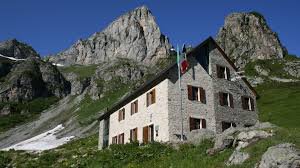
Rifugio Havis De Giorgio - Mondovì
The Mondovì Refuge is an oasis of peace at over 1700 meters above sea level, a magical place where spectacular nature envelops you in wonders.
Come and visit us, Mariolino's cuisine awaits you, with its legendary blueberry tarts, fondues, mountain pasture raschera... as many as 61 beds can also accommodate large companies! - Mountain Hut
Mountain Hut
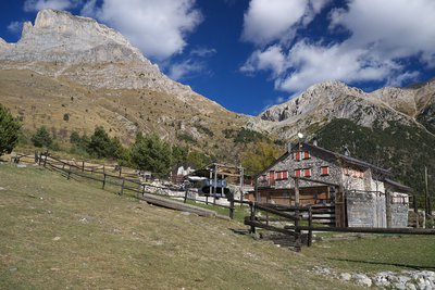
Rifugio Mongioie
Located on the large plateau (Pian Rosso) above the town of Viozene, the Mongioie refuge is the ideal starting point for excursions at high altitude.
The Mongioie massif (2630m) slopes down towards the refuge with spectacular limestone formations up to 350m high where you can climb beautiful rock.
In addition, there are many activities related to the mountain accompanied by typical and seasonal cuisine.