2. Giro del Marguareis, stage 02: from Rifugio Garelli to Rifugio Mondovì
Pastures, eroded limestone and an ephemeral lake, which is dry in summer are the features which make this short crossing interesting.
2 points of interest
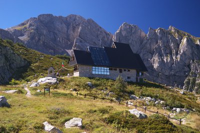
Il vecchio Rifugio Garelli - CAI Mondovì  History and historical trail
Pier Mario Garelli
The refuge was dedicated to Pier Mario Garelli when it was built. He was known to all as Piero, a lawyer and climbing partner of Sandro Comino. President of the CAI of Mondovì, immediately after the armistice he joined the Resistance, with the III Alpine Division operating in Val Casotto. He was arrested in Mondovì, and initially locked up in Turin. On May 25, 1944 he was transferred to the concentration camp at Fossoli, then to Bolzano and finally to the concentration camp at Mauthausen. He died in the subcamp of Gusen, just before the end of hostilities.
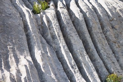
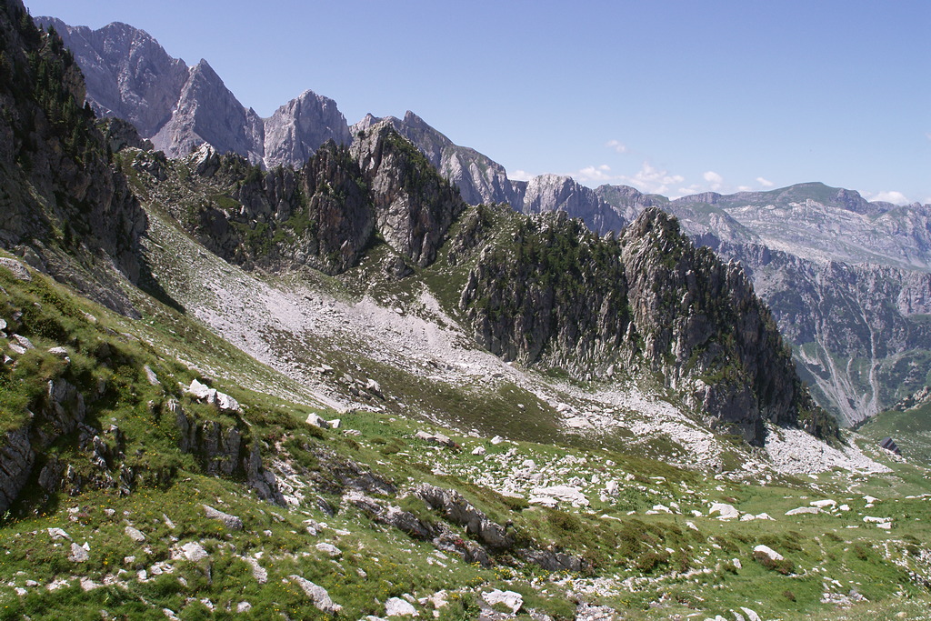
Fenomeni erosivi su rocce calcaree - Roberto Pockaj  Geology
The furrowed fields
The 'furrowed fields' (also called 'carried fields' due to the shapes that vaguely recall the furrows left by the wheels of carts in the mud) are erosion phenomena typical of limestone rocks, due to the runoff of rainwater.
Description
Opposite the Garelli refuge (1966 m), an evident path that crosses the grassy plain of Pian del Lupo branches off to the east. The path climbs the valley amongst grass and rocks, initially keeping to the right of the valley as you climb, then it follows the edge of some scree and moves to the left.
Now on the left of the valley as you climb the path winds through undulating slopes (the path is a little confused by the many tracks that cross it) and after a few turns, you reach the wide grassy saddle at Porta Sestrera (2228 m, 0:50 mins from Rifugio Garelli).
At the pass you ignore the track on the left for Lago delle Moie and descend on the Valle Ellero side. You drop down through grassy hillocks ignoring a turning for Colle del Pas to the right, continue the descent guided by the trail marker posts until you reach a second path to the Colle del Pas.
Follow it to the left, crossing high up on the Lake Biecai basin. After passing a stream, there is a short climb to reach a not very evident junction: you ignore the track to the left for Lago delle Moie and carry straight on. Contour all the way around the Lake Biecai basin until you reach the narrow passage known as Porta Biecai (2004 m).
With gradually wider switchbacks, you drop down sharply from the rocky bastion that closes the basin of Lake Biecai. A long gently inclined stretch takes you through meadows, swampy ground (suitably paved), and areas of thick bushes. Skirt around the foot of Punta Havis De Giorgio, then the path reverses direction of travel and in a few minutes descends to the Rifugio Mondovì Havis De Giorgio (1755 m, 1:05 hours from Porta Sestrera).
- Departure : Rifugio Garelli (1966 m)
- Arrival : Rifugio Mondovì Havis De Giorgio (1755 m)
- Towns crossed : Chiusa di Pesio
Altimetric profile
Report a problem or an error
If you have found an error on this page or if you have noticed any problems during your hike, please report them to us here:
Close by2
- Mountain Hut
Mountain Hut
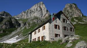
Rifugio Havis De Giorgio - Mondovì
The Mondovì Refuge is an oasis of peace at over 1700 meters above sea level, a magical place where spectacular nature envelops you in wonders.
Come and visit us, Mariolino's cuisine awaits you, with its legendary blueberry tarts, fondues, mountain pasture raschera... as many as 61 beds can also accommodate large companies!