Fremamorta Pass
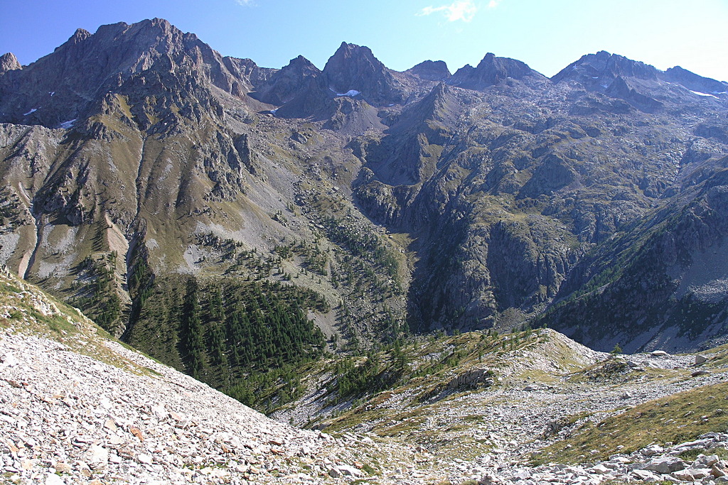
Climb through a primarily detrictic landscape, characterized by a number of lakes, which can be seen from the pass: the Fremamorta Lakes on one side, in single file, and the Lacs de Fremamorte on the other slope, on the French side.
1 point of interest
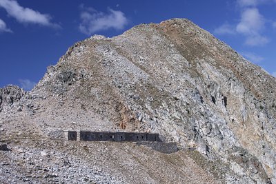
La Casermetta difensiva Colle Fremamorta e la Cima di Fremamorta - Roberto Pockaj  History and historical trail
The Cima di Fremamorta barracks
The barracks building is an imposing structure and is still in relatively good condition: The camouflage paint on the doors is still visible, and there are a good number of windows and doors left, outside and inside. Outside, there are traces of the open-air kitchen, used by the troops during the warm months. The barracks could house a garrison of 60.
Along the last stretch of uphill trail, as well as in the nearby Val Morta, there remain a few telephone poles in larch, on which were strung the wires for communications between defensive outposts.
Description
From Pian della Casa del Re (1735 m), the trail follows the same route as the "Il Colle di Ciriegia" itinerary until the second turnoff on the right (signaled), for the intermediate Lake Fremamorta and Colle di Fremamorta (ignore the first turnoff to the right, also for the intermediate Lake Fremamorta).
The route abandons the mule track for Colle di Ciriegia and climbs to the right, in tight, steep switchbacks through a thicket of green alders. Further uphill, the trail rejoins the old mule track, which rises up to the top of a ridge. Just at the crest of the ridge, there is a turnoff (large cairn). The route abandons the mule track for intermediate Lake Fremamorta and turns left, on the narrow path that leads directly to Colle di Fremamorta.
The trail climbs fairly steeply up the ridge, then curves slightly to the right and enters a small, detritic valley. It goes around a large boulder protruding in the middle of the valley on the right, and climbs up a steep slope with an endless series of tight turns. The trail then turns right and continues its ascent until it reaches the former military mule track coming from the Fremamorta Lakes.
The route follows the mule track to the left and climbs up the slope with a series of long switchbacks until coming to a well-marked fork: the path on the right leads to the western Colle di Fremamorta and the Alpine Corps barracks of the same name, while the trail to the left leads to the eastern Colle di Fremamorta (or simply Colle di Fremamorta, 2616 m, 2 hours and 35 minutes from Pian della Casa), where it reaches the pass.
- Departure : Pian della Casa del Re (1735 m)
- Arrival : Colle di Fremamorta (2616 m)
- Towns crossed : Valdieri
Altimetric profile
Recommandations
Access and parking
From Borgo San Dalmazzo go up the Valle Gesso. After Valdieri, continue up to Terme. Passing behind the Terme hotel, go up to the left in the Vallone della Valletta until the end of the road (dirt in the last stretch) at Pian della Casa.
Those who do not wish to drive the unpaved section from Gias delle Mosche to Pian della Casa del Re - where the trail begins - will have to continue on foot. You’ll ascend the Vallone della Valletta, first through larch and fir trees, then through pastures, pine trees, and scattered larch trees; at a slightly steeper section of the climb, the surface becomes paved again and remains so until you reach a recently renovated mountain pasture, the Gias Nuovo della Casa. Ignoring the brief detour to the right that leads to the mountain pasture, stay on the main dirt road until you reach the entrance to Pian della Casa del Re: The journey takes about 35 minutes, with an elevation gain of about 150 meters.
Report a problem or an error
If you have found an error on this page or if you have noticed any problems during your hike, please report them to us here: