Péone, heritage trail
13 points of interest

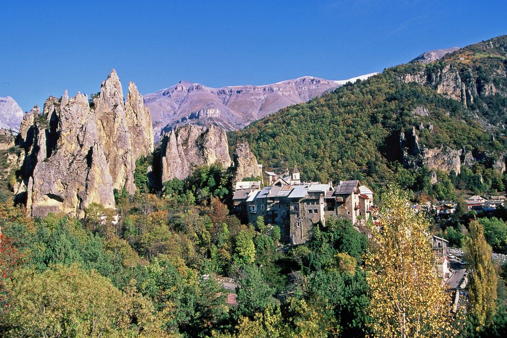
A l'intérieur du village médiéval de Péone. Poutre de soutènement de façade. - EVENOT Marc  History and historical trail
A little history
Using the high-altitude cols to move around, transhumant shepherds have used the Alpine meadows for pasture since time immemorial.
The first known act dates from 1291 and it set the boundaries between the communities of Guillaumes and Péone.
The “castrum de Pédona” can be dated to the start of the 13th century, its castle perched atop the rocky stacks with the first dwellings at its feet.
The people of Péone subsisted on sheep and goat farming as well as the difficult task of working he land until the middle of the 20th century.
Their nomadic nature within the vast and rough territory of a commune is an originality in the Alps.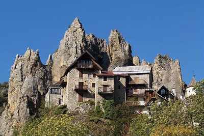
Le village de Péone, les aiguilles calcaires nommées les demoiselles en arrière plan du village. - EVENOT Marc  History and historical trail
The upper tower
...or the Belleudy Tower.
We are now at the foot of one of the two towers which reinforced protection of the village in the 16th century.
As is generally the case in the Maritime Alps, the village of Péone originated when the castle was built, at the start of the 13th century. Péone castle stood among the boulders which currently overlook the village, of which we can still today see traces at the top of the stacks.
A cluster of building then sprung up at the foot of the boulders, shut off by a perimeter wall. This is known as a “castrum” (castle + village), a zone which today is unoccupied.
Lower down, to the south-west, the oldest part of the current village, including the church, could date back to the 14th century.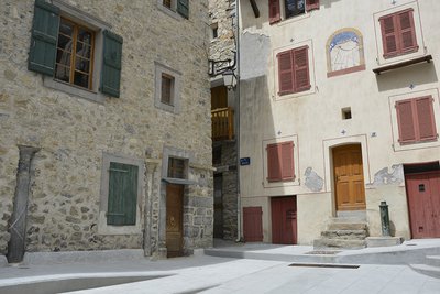
La place du 22E BCA à Péone - Leslie AMIEL  History and historical trail
22nd Batallion of Alpine Hunters Square
The 22nd Batallion of Alpine Hunters was founded by imperial decree in 1855 and set up its garrison in Nice. After 1960, it focused its activities on Alpes-Maritimes and campaigns in the Algerian War.
It was dissolved on 1st August 1976, and the square was inaugurated in the same year.
It is obvious that this square has not always existed as it opens up a gap in the village defensive wall. It can be imagined that the fires which swept through the village were the cause of destruction for the building which used to stand here. Building materials, which were very valuable at the time, were probably reused, as a period of peace rendered these defensive elements redundant.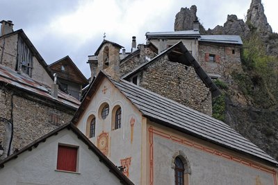
Quelques maisons et la chapelle des Pénitents Blancs à Péone - Eric LE BOUTEILLER  History and historical trail
Chapelle des Pénitents Blancs
The Péone chapelle des Pénitents is mentioned in the first half of the 17th century. Restored in 1976 by private individuals, it has belonged to the commune for several years.
The people of the mountains had a difficult day-to-day life, in addition to the terrors of epidemics, wars and famine.
The presence of the confraternities of the Pénitents and the many places of worship can be explained by the people’s requirement to find help and protection.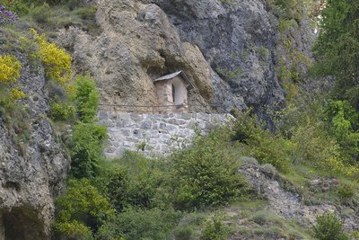
L'Oratoire St Grat à Péone - Leslie AMIEL  History and historical trail
St Grat oratory
With territory spread over 48km² to which access is made difficult by the omnipresent slopes, the rough mountain climate and the requirement of making the most of the various resources of the area have led the inhabitants of Peone to be nomadic around the territory of their own commune. This is more or less a unique example of such a place in the western Alps.
Of the 700 to 800 people included in the 1703 census, 533 were spread among the farms scattered across the landscape as opposed to just 209 in the dwelling areas of the village.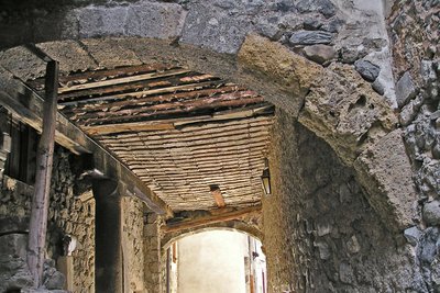
Ruelle en partie couverte dans le village médiéval de Péone. - Marc EVENOT  History and historical trail
Medieval architecture
The first dwellings, small wooden and stone houses clustered together, perhaps around a church, at the foot of the castle have not left their mark. All through the village, we can find elements which are characteristic of the different architectural styles from throughout history.
Many elements have been reused over the centuries: demolition of certain buildings has allowed others to be built of strengthened.
The half-timbered facades represent an original aspect because although use of timber in walls is often to be seen in isolated mountain buildings, it is very rare in towns in Alpes-Maritimes.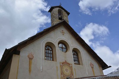
Leslie AMIEL  History and historical trail
The formation of parishes
In religious terms, the parish of Péone was part of the see of (Entrevaux) until it was abolished in 1798.
The first worshippers in the high valley only had one place of worship, the church of Notre-Dame du Buey in Guillaumes, where the bishop preached, celebrating the sacred mysteries surrounded by priests and other ministers.
The gospel was making rapid progress in the countryside and there was a need to found churches in the villages and to send priests to then.
The old churches in the area were perhaps built on the sites of Pagan temples from the Gallo-Roman era. Sometimes, old headstones were used as the holy water font or the altar.
 History and historical trail
The Chamar ascent
Imagine that you have to go and fetch water at the fountain, at the “casette” spring or at Tuébi and then carry it all the way up!
It was not until the middle of the 20th century that the water and sewer network came to the old village.
Water becomes more precious when it is not widely available. In the absence of a spring, rainwater was recovered from roofs on rainy days or when the snow melted; it was then stored in water tanks.
The buildings located close by were linked to the latter via a series of larch wood gutters.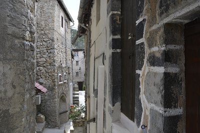
Rue de la Chabriette à Péone - Leslie AMIEL  History and historical trail
Rue de la Chabriette
When heading down le chemin des demoiselles, under the ivy you can see the remains of walls and a cut stone which probably served as a stable for small animals. “Chabrairetto” means little goat keeper.
We then reach the oldest part of the village which is still standing. Certain dwellings unoccupied for 50 years have kept the memory of the old way of life.
Even if they are little used, the houses in the village are still handed down from generation to generation.
The presence of identified stables shows that most of the animals stayed in country houses.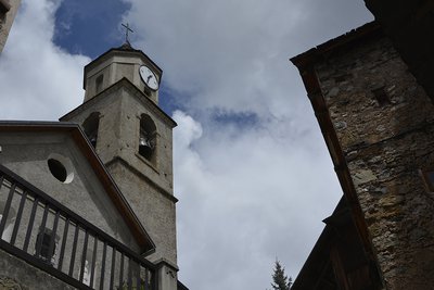
Rue du Four à Péone - Leslie AMIEL  History and historical trail
Rue du four
Of necessity, the typical person from was a peasant and an artisan; the community was virtually self-sufficient in terms of what it produced and made.
This involves a good number of trades and knowledge which have mainly been forgotten today.
In 1789, there was: a surgeon, a doctor, two notaries, a schoolmaster and schoolmistress, four masons, two carpenters, six farriers, but also a paper maker, 7 shoemakers, a maker, a cook, restauranteur and a weaver.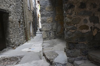
La rue Etroite, Péone - Leslie AMIEL  History and historical trail
Narrow road
Although when they are initially built the roads are wide, the increasing population force villagers to gain some room by adding extensions.
An extra floor was often added or houses overlooking the access roads were widened as they were high enough not to obstruct traffic.
The land registry report made in the 19th century confirm that the road was already like this and that at the time it was called “Traversière du Four”. It was certainly wider at one stage than narrowed due to construction or the additions to buildings here and there. This was a secondary road and it could have almost become a covered one, like the Passage des “catines” a little further on.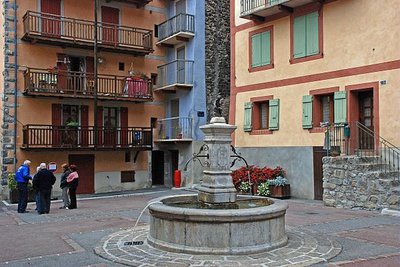
Fontaine et façades colorées place Thomas Guérin à Péone - LE BOUTEILLER Eric  History and historical trail
Thomas Guérin Square
Times of peace provided a chance to build outside of village productions.
Here, the facades have more spacious openings in them, letting in more light and there, shops were set up, the ditch was filled in and the square was born. In 1814 it was bordered by the buildings located to the south, along what is now the road to Guillaumes.
Wherever you go, the village square is a place where people meet up, a place of commerce and assembly, a break after long months of work.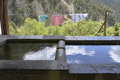
Les lavoirs de Péone - Jean-Louis COSSA  History and historical trail
The wash house
Although families would share work between them throughout the year, washing laundry was work for women only. Even more work in already busy lives.
Until the middle of the 20th century, in the absence of washing machines, the laundry was only washed a few times per year, weather permitting.
There were so many stages and they were so long that it took up a whole day.
This chore was done at the wash house, in the mountain stream, in a wooden tub or on a wash table which allowed the work to be done standing up.
Description
To explore the medieval village passing through its alleys, follow the plaques on the floor which indicate the different points of interest.
To complement the walk, it is also possible to visit the former site of the castle with its panoramic views. From the bridge, a 15-minutes walk along the path will lead you to the Belvédère des Aiguilles.- Departure : Péone Bridge
- Arrival : Péone Bridge
- Towns crossed : Péone
Altimetric profile
Recommandations
Access to the remains of the castle which are still visible is very difficult.
For safety reasons, it is strongly recommended that you remain on the marked path.Information desks
Maison du Parc national du mercantour - La maison Valberganne
Rue Saint Jean, 06470 Valberg
La Maison du Parc du Mercantour propose de nombreuses activités de sensibilisation sur la nature et l'environnement pour les enfants, ainsi que des projections, jeux nature et vente de publications.
Horaires
Toute l'année de 9h à 18h.
Ouverture du 9h à 12h puis de 14h à 18h. Fermé le mercredi.
Access and parking
Parking :
More information
Report a problem or an error
If you have found an error on this page or if you have noticed any problems during your hike, please report them to us here:
