La Barlatte watermill
6 points of interest
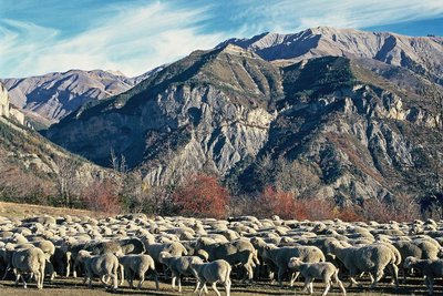
Troupeau de moutons près de Châteauneuf d'Entraunes en automne - COSSA Jean-Louis  Small heritage
Châteauneuf d'Entraunes
Châteauneuf was built during the 12th century. It was run by consuls under the counts of Provence and then the village became the property of the Count of Savoie in 1388 and one of the strongholds of the Baron de Beuil. It suffered terrible damage during the wars between Charles Quint and King Francis I of France (1536) and the French Wars of Religion. In 1621, the people of Châteauneuf bought their freedom. The parish church of St Nicolas (17th century) is built on the site of the castle. It was restored in 1934 and its baroque interior is remarkable for its wealth of colours.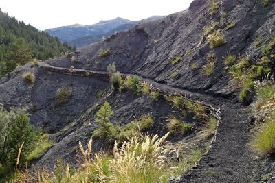
passage dans les marnes près de Châteauneuf d'Entraunes, - Marc EVENOT  Geology
Marl
This landscape of ravine slopes is the result of high pressure caused by human activities, causing the destruction of the forest and the ground it maintained. These black lands are sedimentary rocks which were generally formed at the bottom of the seas during the secondary era; they are made of a mixture of limestone and clay which can easily be altered at chemically and mechanically. The force of the rainfall in addition to the slope are favourable to a high level of erosion.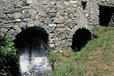
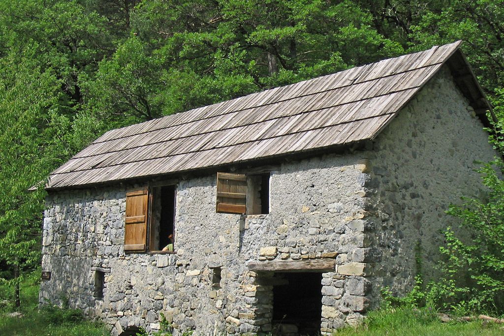
Les eaux du moulin de la Barlatte. - Daniel DEMONTOUX Small heritageThe Barlatte mill
The cogs and water wheels at Monsieur Jusbert’s mill have been silent since 1942. Until this date, the peasants from the surrounding villages and hamlets would go down to the mill with their mule. The sieved flour would be used for bread and to feed the animals.
When the population of the area was at its highest, the miller worked for a thousand people. Since 1993, the National Park, along with the “Gardaren Casteù-Nou” association, has renovated the mill, saving a bat colony by providing an adapted area for them to reproduce in peacefully.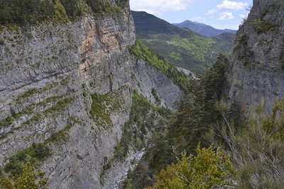
Les Gorges de Saucha Negra - Jean-Louis COSSA GeologyThe Saucha Negra gorges
The gorges are the manifestation of a typical limestone landscape. These steep walls are the result of the action of rainwater which, charged with carbonic gas, dissolve the limestone and penetrate into the rocks, creating underground drainage networks which grow gradually bigger.
Then the upper part collapses and the river flows in the open air, trapped between two vertical walls.
The return journey to pick up the itinerary takes place along the same track.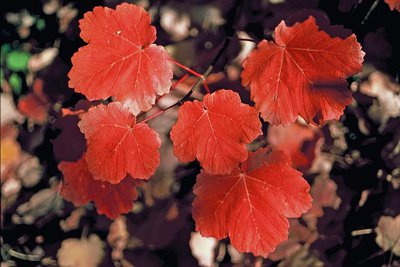
Feuilles d'érable (Acer), bien rouges en automne - ROBION Cédric  Flora
FloraThe Roumegier woods
With the decline in rural activity and farming, the bocage landscapes have tended to alter. The forest has recolonised pasture zones. The southern slope is host to the species which appreciate limestone ground, such as Scotch pine, whose light foliage allows light to reach the undergrowth, thereby allowing hazelnut trees and whitebeam to develop. Despite the trend towards colonisation by Scotch pine, the downy oak has also managed to remain. The boxwood, which is also there, could be as old as 500 years. In lesser quantities, there are also maples, dogwood, rowans and laburnum, which are used to make collars for pets.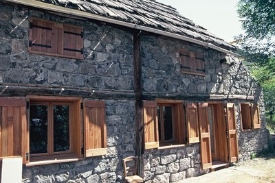
La grande cabane pastorale de Barels (sur la commune de Guillaumes) - Daniel DEMONTOUX  History and historical trail
History of a landscape
Above the Tourrès track, opened in 1910, the limestone cliffs, protected by a prefectorial Biotope decree, are the reproduction ground for several birds of prey: golden eagle, peregrine falcon, Eurasian eagle owl… The whole area appears natural and wild but the remains of old crop beds or hay meadows, ruined farms or barns and even an entire ruined hamlet, Barels (located within the boundaries of the commune of Guillaumes), provide an insight into how life was long ago.
Each plot of land was cultivated using a mule or a mare, the indispensable assistants for humans at the time.
In 1828, Châteauneuf has 298 inhabitants living entirely self-sufficiently thanks to their agricultural activities.
Description
From the village, take the stony path for Les Tourrès, overlooking the Barlatte valley. At marker 198, head right into the Roumegier woods; the path descends rapidly in zigzags in the shade of the Scotch pines.
At marker 197, the path cuts across the channel which formerly supplied the village of Châteauneuf with water. Continue through a wood of deciduous trees and reach marker 196, above the mill.
The latter is nestled in the heart of a clearing, a calme and restful place to take a short break. Rejoin the path and follow directions for “Châteauneuf”. The path includes shady zones and areas of marlstone which are fitted with a handrail.
The itinerary ends with a visit of the village of Châteauneuf.
A short variation is possible at marker 197: it allows you, by following the former canal path, to reach the remarkable Saucha Negra gorges where the Barlatte flows, providing water for the irrigation channel for the village and for the watermill.- Departure : Entrance to the village, marker 191
- Arrival : Entrance to the village, marker 191
- Towns crossed : Châteauneuf-d'Entraunes
Altimetric profile
Information desks
Office du tourisme de Guillaumes
25 Place de Provence, 06470 Guillaumes
Access and parking
Parking :
Report a problem or an error
If you have found an error on this page or if you have noticed any problems during your hike, please report them to us here: