Le Bois de la Moulière
6 points of interest
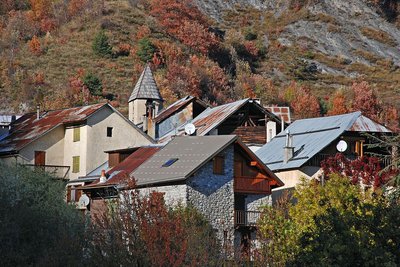
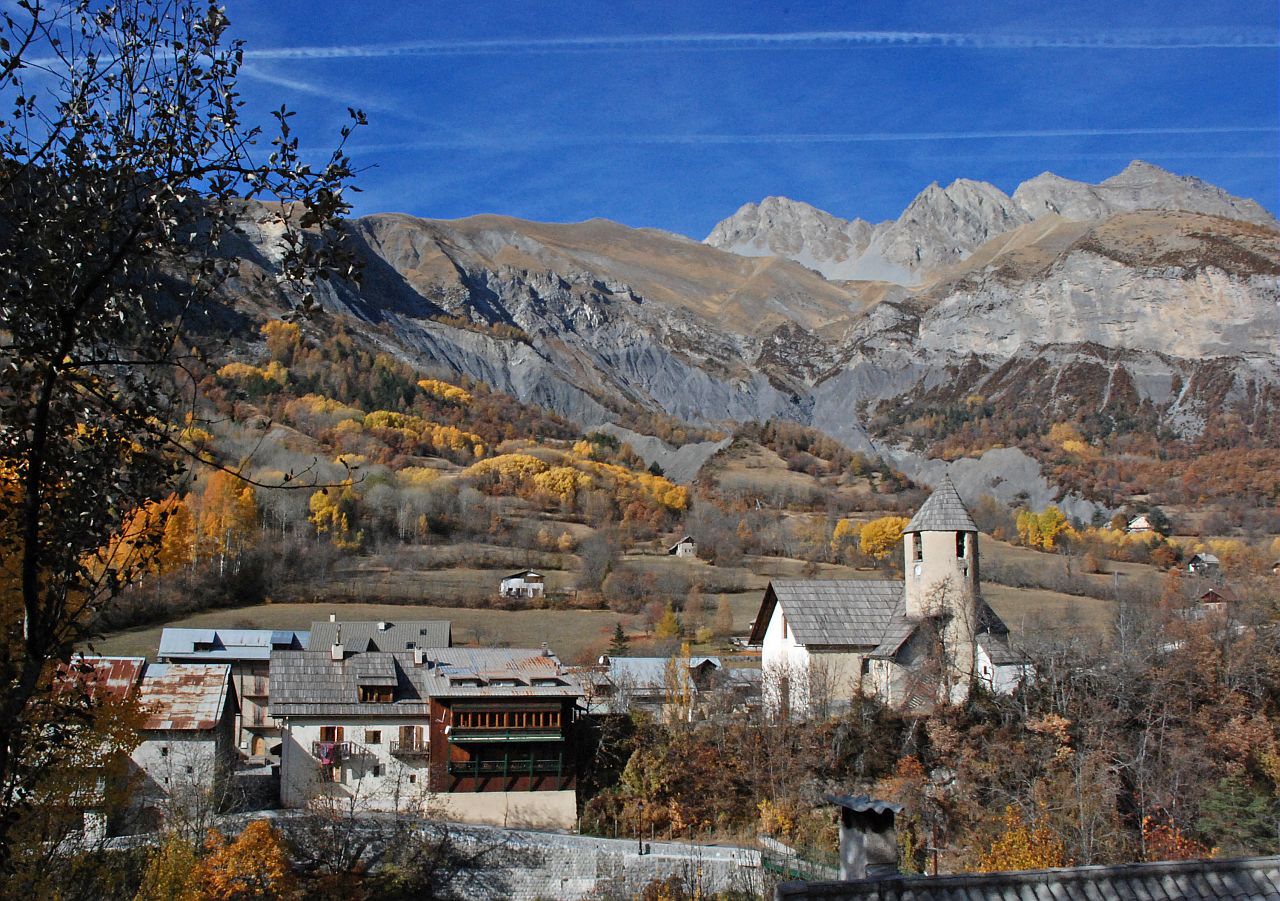
Emergeant de la végétation, les toits et le clocher typique du village d'Entraunes, au mois d'octobre. - Eric LE BOUTEILLER  Small heritage
The village of Entraunes
Around its asymmetrical bell tower which is contiguous with the parish church, the village of Entraunes has a wealth of both rural and religious heritage: the painted chapel of St Sébastien which is classified as a historical monument, armouries or an anthropomorphic sculpture, border markers… Come and visit the village of Entraunes thanks to its heritage trail (information available at the townhall or from the information point in July/August).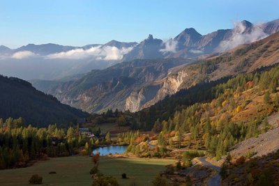
Estenc et son petit lac, son plan-d'eau au dessus d'Entraunes dans le haut-Var-Cians. Vue sur le val d'Entraunes. - GOURON Claude  Pastoralism
Agro-pastoral life
Around the village, there are still hay meadows. Still used today by the few farmers still in the commune, they reflect the high level of agro-pastoral activity which existed until midway through the 20th century. Little by little, these prairies have been colonised by vegetation. The high-altitude pastures located above the cliffs play host to domestic transhumant herds in summer. It appears that the village which, long ago, was located on the right bank of the Var was destroyed by a landslide from the cliff of Pénas.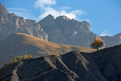
Paysage du Haut-Var-Cians à Entraunes,marnes noires en premier plan, surmontées de falaises - GOURON Claude  Geology
The Bourdous valley
The black marl of the Bourdous valley is continuously being eroded with every storm that comes. Maintaining the slopes is hard work that humans have been trying to do since 1860 after overuse of the woods and pastures until the 19th century. To stop this erosion, the Waters and Forests Service replanted the entire valley and major civil engineering work was carried out. The landscape you see is the fruit of this largescale work.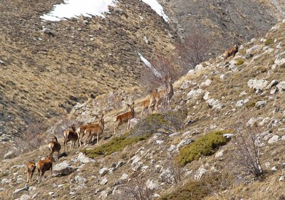
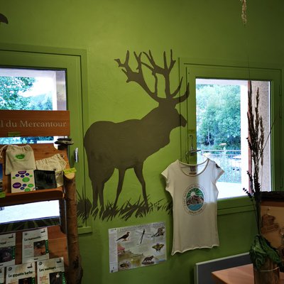
Sur les hauteurs d'Entraunes, des cerfs élaphe et des biches, qui rencontrent un chamois, (Rupicapra rupicapra) - BENSA Marion  Fauna
FaunaRed deer (Cervus elaphus)
Between mid-September and mid-October, at dawn or dusk, listen out: this is the rutting period for stags and their roars and barks can often be heard echoing through the Mercantour valleys.
This is a very tiring period for the stags as they do not have time to eat properly. As soon as the rutting period is over, they have to quickly put on weight to be ready for winter.
Stags weigh between 130 and 180kg and does between 80 and 110kg. Stags stand at 1.20m to 1.40m tall and can live for up to 15 years.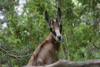
Chamois, (Rupicapra rupicapra), portrait d'éterlou - MALTHIEUX Laurent FaunaDifferent levels, different animals!
The grasses found in the little suspended valley of La Fracchia above the black marls are much sought after by deer. Higher up, above the cliffs, chamois are most often to be found in the Alpine pastures: the females and juveniles in herds and the males alone. Higher still, on the rocky peaks of Roche-grande, can be found the territory of the ibex.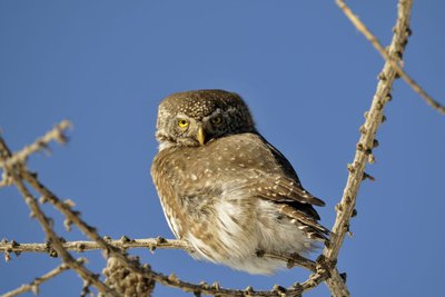
Chouette chevêchette ( Glaucidium passerinum), perchée sur une branche au début du printemps, famille des strigidae. - Jacques BLANC FaunaEuropean pygmy owl (Glaucidium passerinum)
The smallest nocturnal bird of prey, the Eurasian pygmy owl is a mountain owl which is somewhat rare in the southern Alps. It seeks forests with varied strata: it uses dense areas for shelter whereas the more open zones are its hunting ground, as it looks for shrews, voles and field mice. It also likes small passerines like blue tits. It uses the cavities dug by woodpeckers for nesting but also to store its prey.
Description
Cross the village via the washhouse until you reach the square where the school is. From there, head down towards the Bourdous valley.
Opposite the old bridge you will find marker 266, take the GR52A (white and red markers). You will find a board which explains the development of the landscape shaped by humans. The track then zigzags up among the whitebeams and the common box, regularly cutting across a forest path.
Before you arrive at Serre, the view opens out, allowing you to admire Roche Grande and the Cime de Pal, two peaks of more than 2600m in altitude which tower over the black marlstone of the Bourdous Valley, a brook which is regularly affected by torrential downpours.
At marker 267, join the path which continues to the left, going past a gate which prevents motorised vehicles from using it. When the path forks, head to the left again.
The path, which runs along the mountainside, gradually heads deeper and deeper into a pine forest. During this section of the hike, a few gaps in the foliage allow you to admire the erosion process in the Bourdous Valley.
Where the valley joins the larger Morière, there are information boards to help you understand the uses of dead wood, which is host to a rare range of biodiversity and an important part of local heritage.
Follow the same route for the return journey.
- Departure : Village of Entraunes
- Arrival : Grande Morière Valley
- Towns crossed : Entraunes
Altimetric profile
Information desks
Point d'Information Touristique Entraunes
La Mairie, 06470 Entraunes
Transport
Information: https://www.departement06.fr/vous-deplacer-en-bus/lignes-et-horaires-3029.html
Access and parking
Parking :
Report a problem or an error
If you have found an error on this page or if you have noticed any problems during your hike, please report them to us here: