The Mongioie
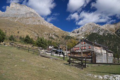
Given the significant elevation gain, this hike takes you through just about all the typical landscapes of the Ligurian Alps: the forests surrounding Viozene, expanses of pastures around the Mongioie Mountain Hut, then patches of pine trees, and finally white limestone rocks on the ascent to Mongioie. The view from the summit of Mongioie—the second-highest peak in the Ligurian Alps—is exceptional.
Description
The trail begins in Viozene (1242 m), behind the parish church. A steep concrete slope leads to a small paved road, which you follow to the right uphill (fountain).
Past the last houses in the village, the road continues as a dirt track. Ignore a fork to the right and you’ll reach a clear junction, where you follow the signs to the left for the “Sentiero Natura.” Shortly after, the dirt track ends at a renovated mountain hut.
Continue along the trail to the right of the hut; ignore a first trail to the left that descends back toward Viozene, then, at the next fork, keep to the right (the left trail is a shortcut). The climb is fairly steep, with a few turns; pass the “Cabana de Cian Ruscet” on your right, and, now out of the woods, you’ll reach the wide pasture plateau of Pian Rosso.
At the next intersection, pass by both the fork leading to Bocchino dell’Aseo and Mongioie (which can be taken by those who do not wish to pass by the shelter) and the one leading to Pian dell’Arma on your right. Instead, turn left (west) and you’ll soon reach the Mongioie Refuge (1550 m, 0:55 hours from Viozene).
Just before the fence enclosing the shelter, heading north-northeast, the trail to Bocchino dell’Aseo branches off. After passing a fork to the left almost immediately, you rejoin the trail that ascends from Viozene, which you left shortly before the shelter.
Following it to the left, you traverse grassy, debris-covered slopes dotted with sparse vegetation; then, after passing a small valley, you leave a branch trail to Bocchino delle Scaglie on your left. You now enter the Vallone della Vastera on a very steep ascent, with tight switchbacks alternating with short, steep traverses through a pine grove.
Beyond the grove, after a few wide turns and a steep traverse, the trail bends to the right (east), leveling out slightly, and with a new series of switchbacks (a spring 10 meters to the right of the trail at approximately 2035 meters) reaches the grassy basin of Pian dell’Olio.
The trail crosses the basin on the orographic right side and resumes a steep ascent to clear the rocky outcrop that seems to close off the valley between imposing limestone walls. The valley, however, ends by opening up, and an easy trail reaches the Bocchino dell’Aseo (2295 m, 2 hours and 10 minutes from the Mongioie Refuge), a wide pass connecting the Tanaro Valley with the head of the Corsaglia Valley.
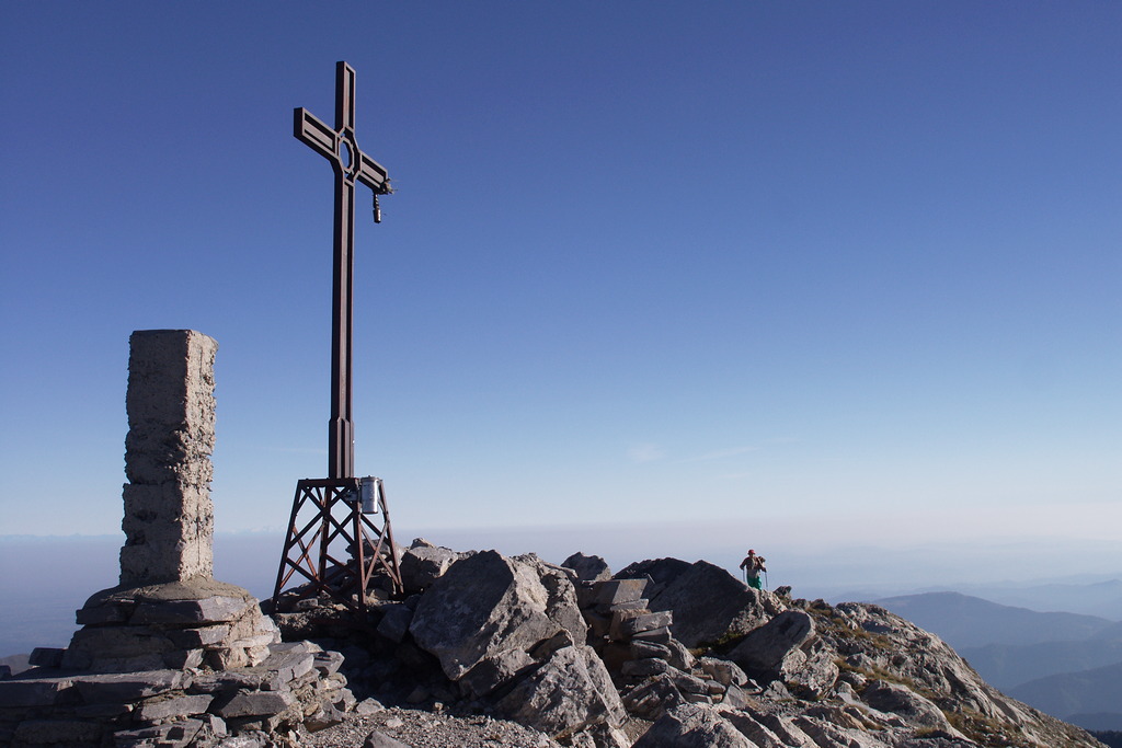
A few meters before Bocchino dell’Aseo, a signpost on the left marks the start of the trail to the summit of Mongioie. The route, which is anything but monotonous, alternates between sections with tight switchbacks, rocky stairways, and traverses. What remains constant, however, are the steep gradient, the loose gravel that makes the climb a bit more difficult, and the gradually widening view. Once you reach the ridge line, follow it over rocky terrain to the left (south-southwest) for a few dozen meters until you reach the cross at the summit of Mongioie (2630 m, 0:50 hours from Bocchino dell’Aseo).
- Departure : Viozene (1242 m)
- Arrival : Mongioie (2630 m)
- Towns crossed : Ormea
Altimetric profile
Access and parking
From Ceva, drive up the Tanaro Valley to Ponte di Nava, where you take the right fork toward Viozene. Leave your car in Viozene.
Report a problem or an error
If you have found an error on this page or if you have noticed any problems during your hike, please report them to us here: