The Monte Armetta Loop
Mount Armetta is a peak offering spectacular views, almost suspended between the sea and the Alps. Most of the ascent takes place on open, sunny grassy slopes, while the final stretch of the loop trail winds through a conifer forest. The spring blooms are breathtaking.
Description
Below the Pian dell’Arma Mountain Hut (1339 m), follow the dirt track to the left; at the first fork, head up to the left until you reach a house.
A trail continues northeast on a gentle slope through old terraces and reaches a fork: to the right, the trail leads to Colle San Bartolomeo, while to the left it climbs to Monte Armetta.
Take the latter route, climbing up a gully with tight switchbacks until you reach the grassy ridge above. Turn left and follow the gentle ridge upward: you’ll cross a dirt track, then rejoin it shortly afterward. Follow it to the right for about fifty meters, until you come to another, slightly wider dirt track.
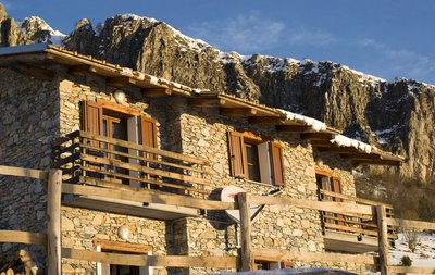
Turn left—again, only for a few dozen meters: when you reach a renovated mountain hut, leave the trail and take the path that branches off to the right. The path runs along the left side of a low dry-stone wall, then climbs fairly steeply across meadows until it reaches Colla Bassa (1570 m), on the main watershed between the Tanaro and Pennavaire valleys.
Turn right; amid grass and exposed rocks, the trail narrows to a faint path (well marked by cairns), then becomes clear again and slowly gains elevation as it winds along the very broad grassy ridge. After passing the trail to Ormea on the left, you climb the slightly steeper slope leading to the summit of Monte Armetta (1744 m, 1 hour 25 minutes from the Pian dell’Arma Mountain Hut).
Return along the ascent route to Colla Bassa, where, instead of turning left toward the refuge, continue straight ahead, keeping slightly to the left of the ridge. A short climb precedes a section along the hillside through pines and shrubs, during which you ignore the detour to Monte della Guardia on the right.
After passing a repeater tower, you return to the ridge; now, in the dense larch forest, you descend for a long stretch along a wide, grassy mule trail until you reach a three-way junction: ignore the trail on the right toward Alpisella and the mule trail that continues straight ahead toward Colle di Caprauna, and turn left. After a short descent through mixed woodland, the mule track narrows to a trail and, after passing a couple of forks on the right, leads to the rear of the Pian dell’Arma Mountain Hut (1339 m, 1 hour 20 minutes from Colla Bassa).
- Departure : Pian dell'Arma Mountain Hut (1339 m)
- Arrival : Pian dell'Arma Mountain Hut (1339 m)
- Towns crossed : Ormea
Altimetric profile
Access and parking
From Ceva, drive up the Tanaro Valley, passing through Garessio and Ormea, then continue toward Imperia until you reach Cantarana, where you turn left toward Caprauna. Just past Colle di Caprauna, a dirt road on the left leads to the Pian dell'Arma Mountain Hut. There are a few parking spaces near the hut.
Report a problem or an error
If you have found an error on this page or if you have noticed any problems during your hike, please report them to us here:
Close by1
- Mountain Hut
Mountain Hut
Rifugio Pian dell’Arma 1350 m
From its 1350 m above sea level, the Refuge offers a breathtaking view of the Ligurian Sea and the cliffs of Rocca dell'Arma. From here, with short walks, the Monte is added
Armetta and the Madonna della Guardia, from which the view embraces the Marguareis Natural Park, the splendid beginning of the western Alpine arc.