
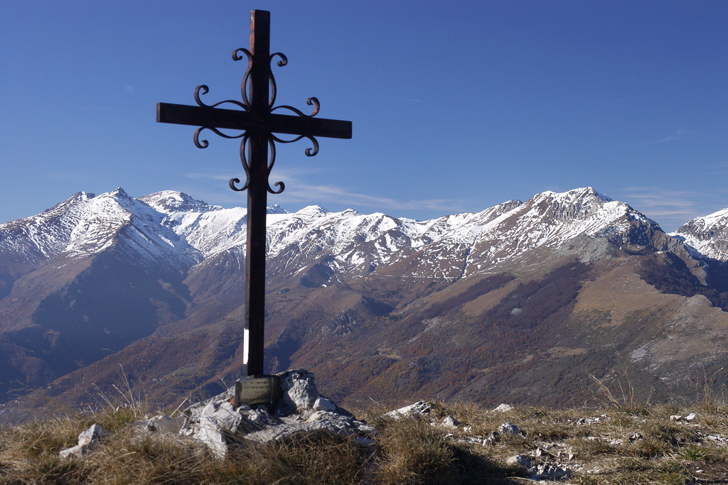
The Monte Galero Loop
A beautiful climb to one of the last peaks of the Alps, before the terrain gradually slopes down toward Liguria. The view is incredibly expansive, stretching from the Alps to the sea, and the rocky pinnacles rising from the western ridge of Monte Galero are truly fascinating. Extensive beech forests characterize the lower-elevation section of the loop.
Description
Right at Bocchino delle Meraviglie (1191 m), the dirt road forks into two forest trails. Follow the left branch, which climbs fairly steeply through the woods. Continue until the first hairpin turn to the right: a few dozen meters past the turn, leave the dirt road—which continues straight ahead—and take a clearly marked trail on the left.
The trail climbs through the beech forest with long traverses and a few switchbacks. When you reach a marked junction, leave the main trail, which continues toward Passo delle Caranche, and turn right.
The trail to Passo delle Caranche also leads to Monte Galero, but it is a longer route with a greater elevation gain. However, the very narrow ridge at Passo delle Caranche is quite distinctive, so those who choose to extend the route will certainly be rewarded.
Within the beech and fir forest, the trail climbs steeply with several switchbacks, quickly gaining elevation and reaching the eastern ridge of Monte Galero. Here, you join the trail coming from Passo delle Caranche, which you follow to the right (west). You follow the wide, panoramic ridge and, over steep slopes, reach the base of the terminal grassy alluvial fan. A short but very steep climb finally leads to the summit of Monte Galero (1709 m, 1 hour 40 minutes from Bocchino delle Meraviglie), where the view stretches 360°.
Continuing along the ridge toward the west, you lose a few meters in elevation and reach a fork: ignore the trail straight ahead—which leads to the western secondary summit of Monte Galero in just a few dozen meters (though a detour there is recommended)—and turn left. After a short traverse south of the secondary summit—which is easy but slightly exposed (be careful if the ground is slippery)—you return to the ridge: a very steep descent, among the characteristic rocky pinnacles rising from the grassy slope, quickly leads to the base of the Monte Galero ridge (1507 m, 0:25 hours from Monte Galero).
Here the trail forks: leave the branch that continues straight ahead toward Colle del Prione, and turn right. The trail descends through the beech forest, then crosses a cleared area (follow the trail markers!) and intersects a dirt track. Back in the woods, the trail reaches a ridge and follows it downhill to the area known as Prato del Poco.
Ignoring the trail ahead toward Trappa, you almost reverse direction, heading east (to the right). You follow an old forest road that winds along, following the contours of the terrain. Upon reaching the Rio Bianco watershed—devastated by a recent landslide—leave the road and descend to the left. After a brief ascent, the narrow trail descends for a long stretch through the beech forest, then quickly gains elevation again with a series of tight turns and arrives at the Fontana delle Meraviglie (1174 m).
A concrete water intake makes the name of this place seem far less poetic: after crossing the small stream that originates there, you climb the few meters leading to a dirt trail. Ignore the left fork of the trail leading to Pilone di Sant’Anna and head up to the right, returning to the nearby Bocchino delle Meraviglie (1191 m, 1 hour 10 minutes from the Monte Galero ridge).
- Departure : Bocchino delle Meraviglie (1191 m)
- Arrival : Bocchino delle Meraviglie (1191 m)
- Towns crossed : Garessio
Altimetric profile
Access and parking
From Ceva, drive up the Tanaro Valley to Garessio, where you turn left toward Albenga. Continue uphill to Colle San Bernardo: on the right, behind a wind turbine, take the dirt road—which starts out in good condition but then deteriorates—and follow it for about three kilometers to reach Bocchino delle Meraviglie (ignore the numerous side roads). A small clearing provides parking for a few cars.
Report a problem or an error
If you have found an error on this page or if you have noticed any problems during your hike, please report them to us here: