
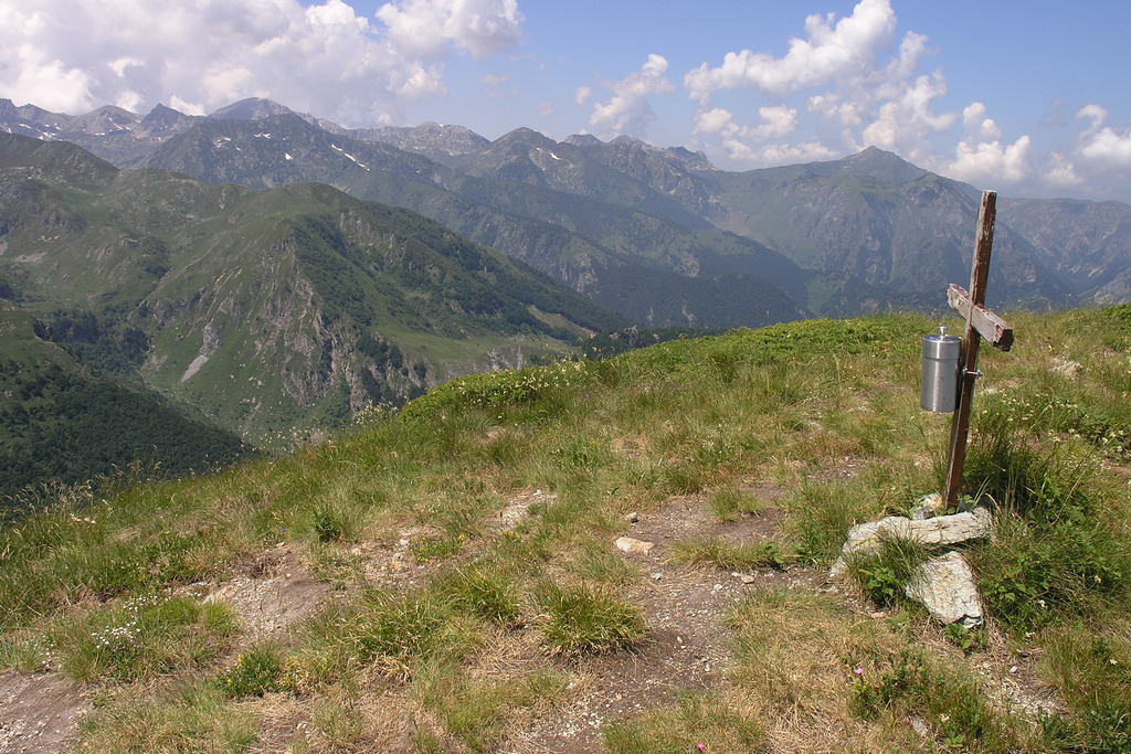
Mount Baussetti
This is a pleasant hike that winds its way through beech forests for a long stretch and ends by crossing the broad, pasture-covered ridge of Cima Robert. The rhododendron blooms in spring are magnificent, and the views are quite impressive despite the relatively low elevation. Fierce battles took place in this area between Piedmontese and French soldiers in 1795.
Description
A dirt road starts from the Colla della Navonera parking lot (1,422 m) heading south, passes the Chapel of the Madonna delle Nevi della Navonera on the right, and climbs quite steeply up the Valle Corsaglia side along the slopes of Punta delle Rocchette.
Once past this modest elevation, a gentle descent leads to a three-way junction: ignore the two logging trails on the left and continue on the wide trail on the right that enters the beech forest (blue arrow on a beech tree). The trail, which grows narrower but remains easy to follow and always clearly marked, cuts across the western slopes of Cima del Nascio on level ground, winding through beech trees and rhododendrons.
Upon reaching a tiny clearing on the pass between Cima del Nascio and Cima Suriot, the trail veers east of the watershed (toward the Casotto Valley) and continues on a gentle descent. Soon you’ll reach a second clearing, near Colla del Giassetto (1,572 m). After crossing it, the trail re-enters the woods and begins a steep ascent along the ridge.
A third small clearing signals a change in the tree cover: the trail crosses a small stream and continues through beech and silver fir trees. You then reach yet another, much larger clearing, covered with shrubs and also crossed by a small stream. The trail passes through this final clearing as well and finally emerges from the woods when you are already at the slopes of Cima Robert, a barely noticeable peak rich in pastures and rhododendrons.
Amid the meadows, you join the trail connecting Monte Baussetti to the Alpe di Robert mountain pasture below: follow it to the left (southeast), beginning to ascend the broad, rounded watershed ridge also known as Pian dell’Accampamento or Pian Robert, site of a recent installation commemorating the military battles that took place here in the late 18th century.
The trail passes Cima Robert (1,819 m, 1 hour 40 minutes from Colla della Navonera), then descends gently toward the south, winding through meadows and rhododendrons. After a final short but steep ascent, you reach the summit of Monte Baussetti (2,002 m, 35 minutes from Cima Robert).
- Departure : Colla della Navonera (1422 m)
- Arrival : Mount Baussetti (2002 m)
- Towns crossed : Roburent, Pamparato, and Garessio
Altimetric profile
Access and parking
From Torre Mondovì, continue toward Pamparato and Valcasotto. In Valcasotto, take a small paved road that descends to the right (signs for Pilone della Navonera), keeping to the right again at the next fork. The long, narrow road turns into a dirt road with a fairly good surface. After the little church of San Lorenzo, take the right at both of the closely spaced forks, then climb up to Colla della Navonera. There is a gravel parking area with space for several cars.
Report a problem or an error
If you have found an error on this page or if you have noticed any problems during your hike, please report them to us here: